by Christian Nilsen
The Stormwater Heatmap team is excited to share a major development milestone!
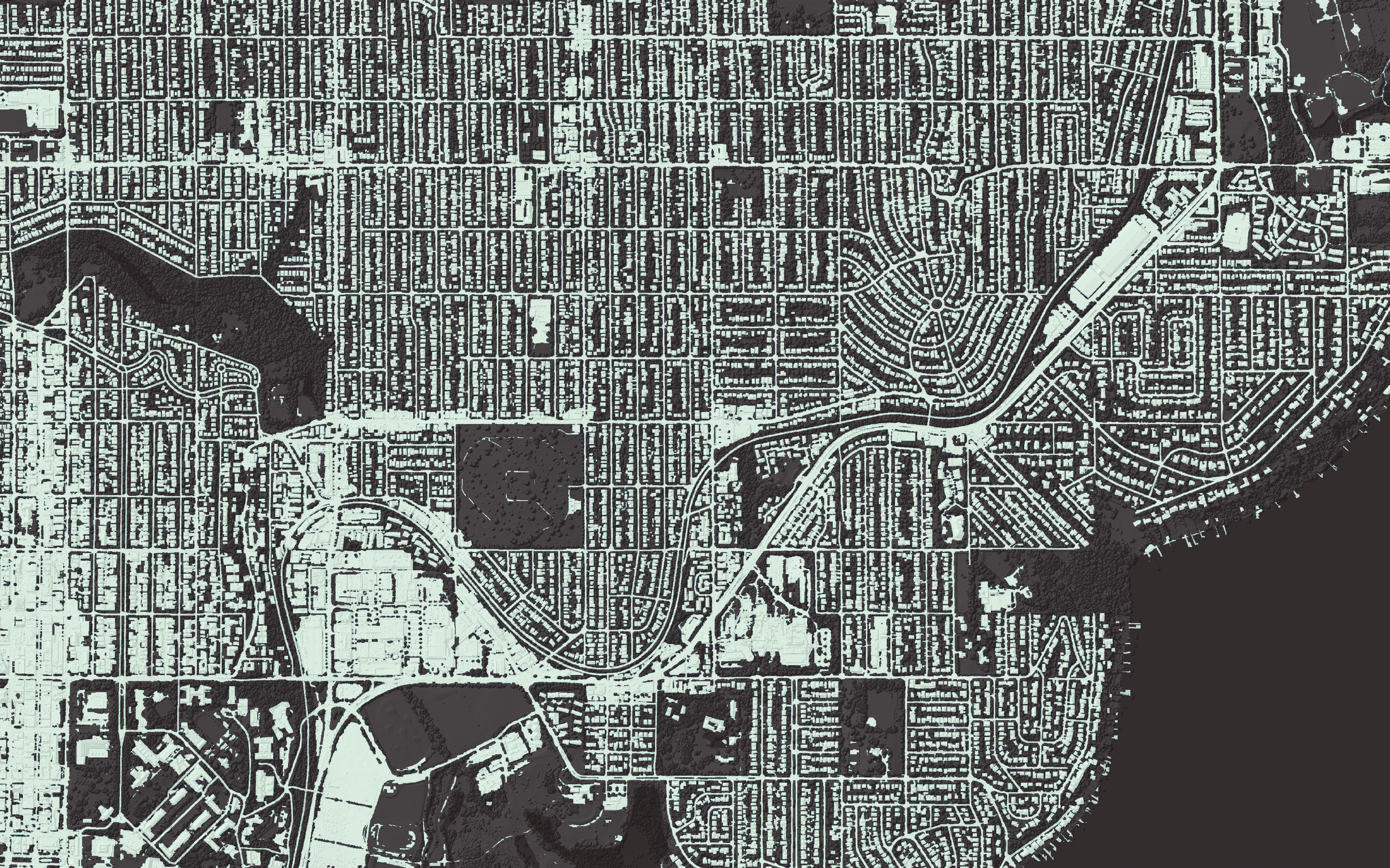
The mapping tool, which models where stormwater pollution is generated across the landscape, has a newly revamped impervious data layer. Impervious surfaces are areas where rainfall is unable to soak through the ground and includes hard surfaces such as roads, sidewalks, and roofs. This results in toxic contaminants washing from these surfaces into waterways, making stormwater the leading cause of toxic pollutants in Puget Sound.
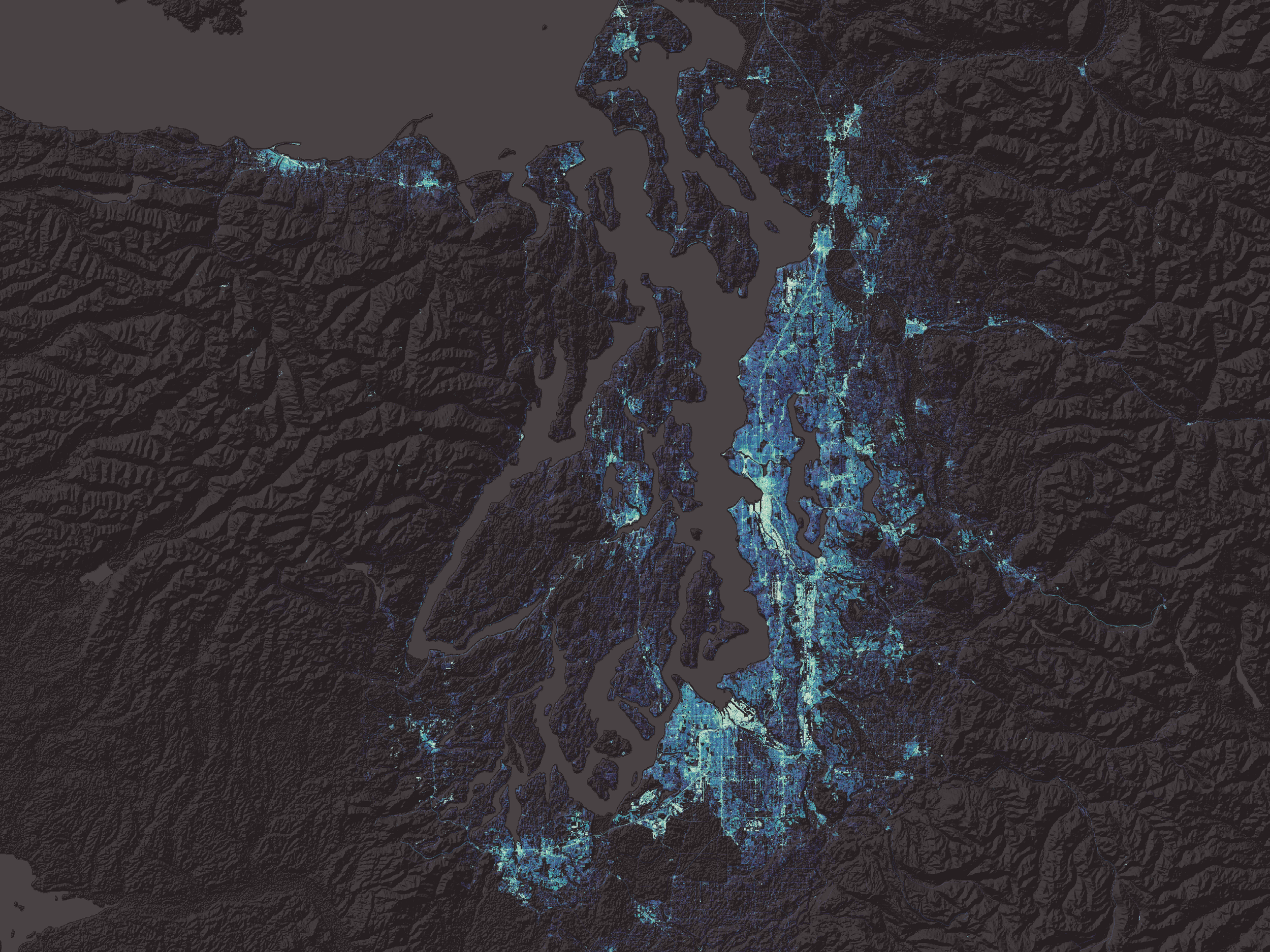
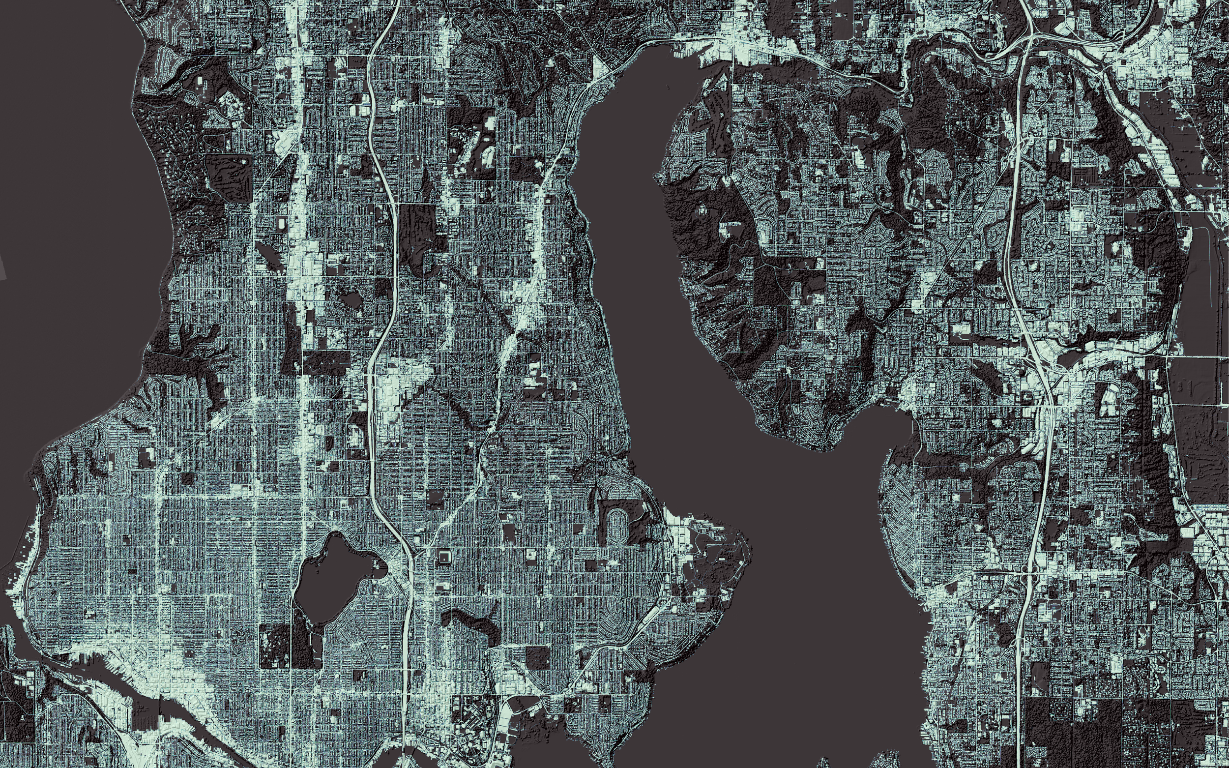

The Stormwater Heatmap imperviousness data layer now represents the most detailed rendering ever made of impervious surfaces in the Puget Sound region. This image, developed by Geosyntec Consultants and The Nature Conservancy, shows every street, parking lot, and rooftop in the region at a resolution of 1M² (one square meter) per pixel. It encapsulates the entire 12,000 square mile Puget Sound watershed, which is an area approximately equivalent to the size of Maryland.

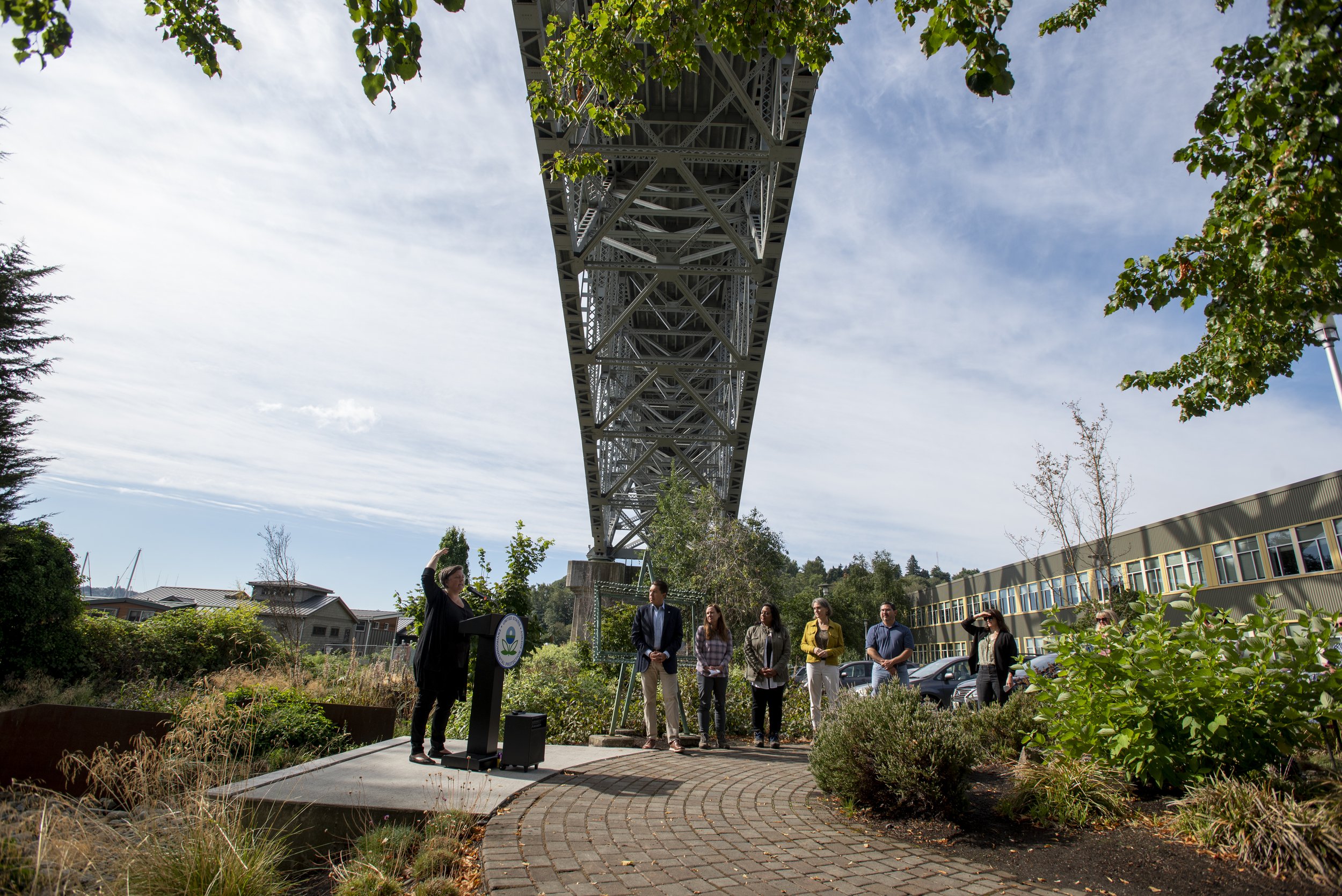
Stormwater runoff. Photo: Hannah Letinich.
The team mapped more than 375,000 acres of imperviousness across the Puget Sound watershed – or enough pavement to build a four-lane highway around the world two times over. This data is freely available for the public to download from www.stormwaterheatmap.org.
This data is being used across the region to better understand the Puget Sound built environment and to improve decision-making for Puget Sound's water quality.
The Stormwater Heatmap team members and advisors include Adam Tycaster, Chad Jennings, Christian Nilsen, Emily Howe, Ericka Hegeman, Eva Dusek Jennings, Jamie Robertson, Jessie Israel, and Sarah Brunelle.
Author Credit: Christian Nilson is a Senior Water Resources Engineer at Geosyntec Consultants. Christian brings over 20 years of experience in watershed planning, stormwater management, and stream restoration, working in both consulting and academia. Christian is a leader in the development of new approaches to address water and environmental challenges. His work has spurred the adoption of new decision support tools to balance infrastructure needs with environmental and community benefits.