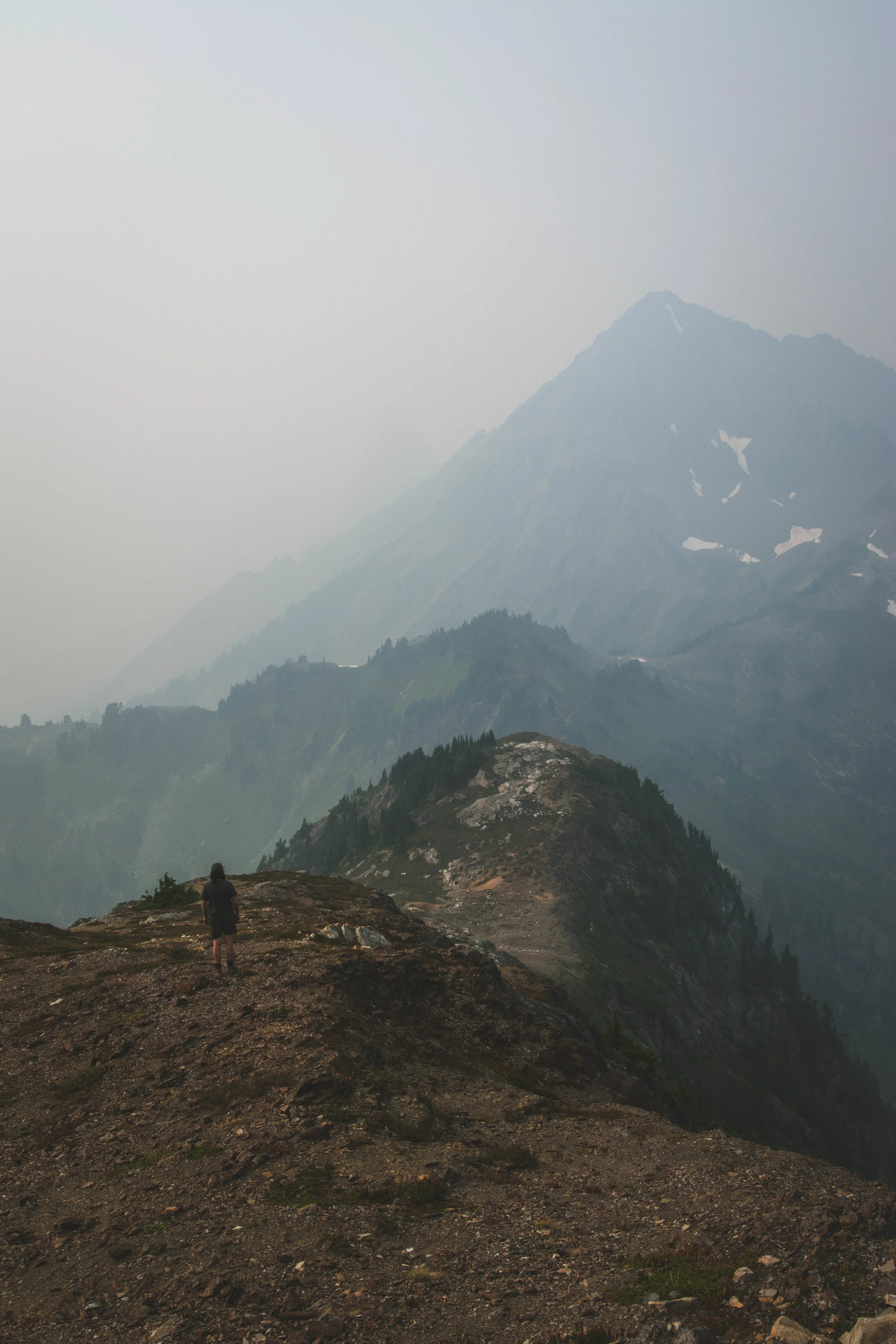
The highest tides of the year offer a glimpse into a future of rising sea levels along Washington’s coast.

Washington shellfish growers receive funding from the Supporting Oyster Aquaculture and Restoration (SOAR) program’s Shellfish Growers Resiliency Fund, investments in new and more sustainable solutions to common aquaculture practices.
Earth Day was born out of a movement to improve the lives of people and nature, inspiring sweeping legislative action and investments. Today, federal infrastructure funding and WA Climate Commitment Act are a continuation of this movement, investments making a tangible impact locally. As an example, Washington’s historic funding of the Floodplains by Design program is contributing to nature-based floodplain management across the state to reduce flood risk, protect communities and protect salmon habitat. These state and federal dollars are just the start of local climate action that will improve the daily lives and the future of all Washingtonians.
Meet DeAnne Hamilton: Learn how the general manager of Tacoma’s KBTC Public Television and TNC in Washington trustee, uses the power of storytelling to engage people in conservation and create a better future for the next generation.
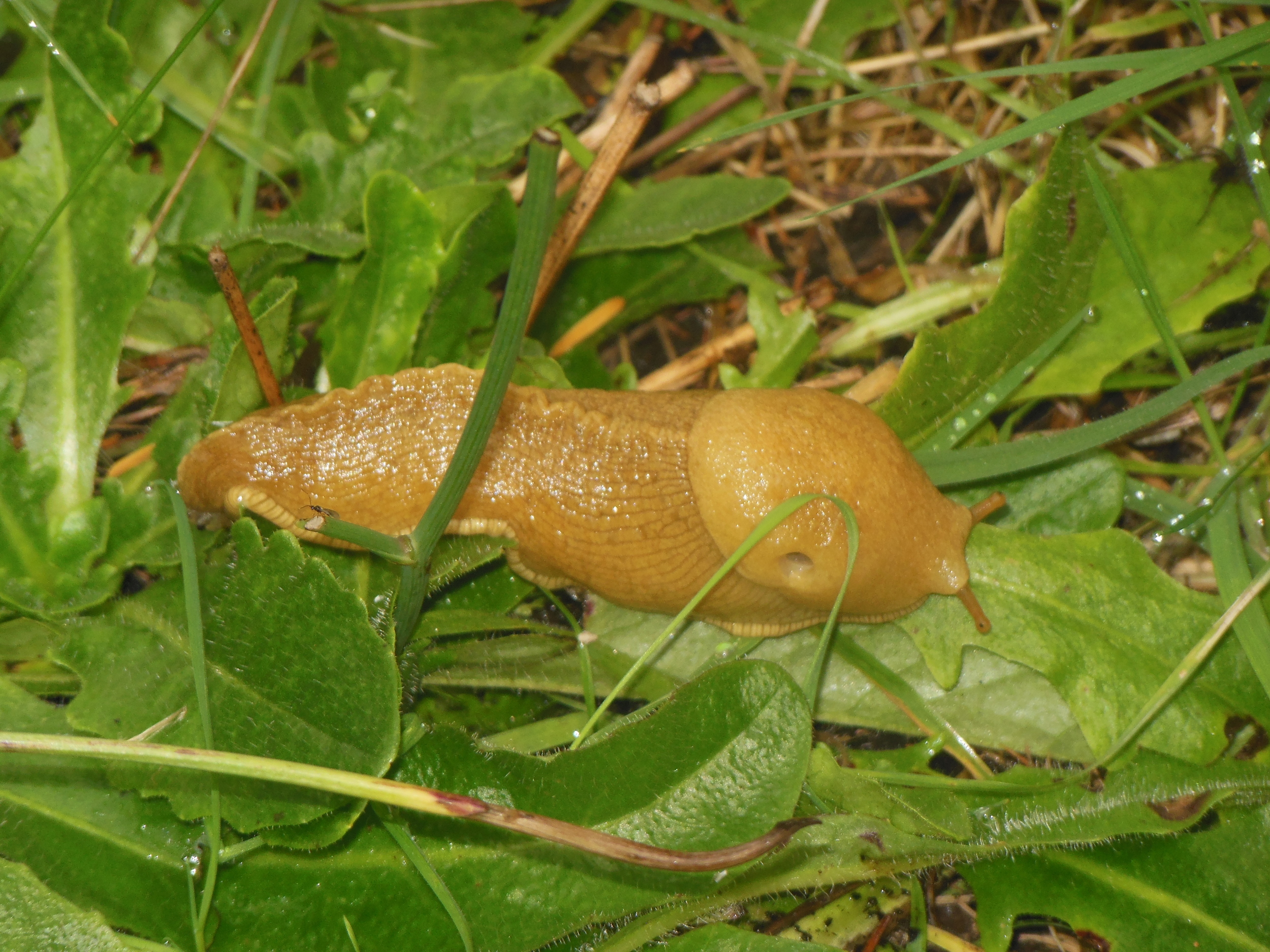
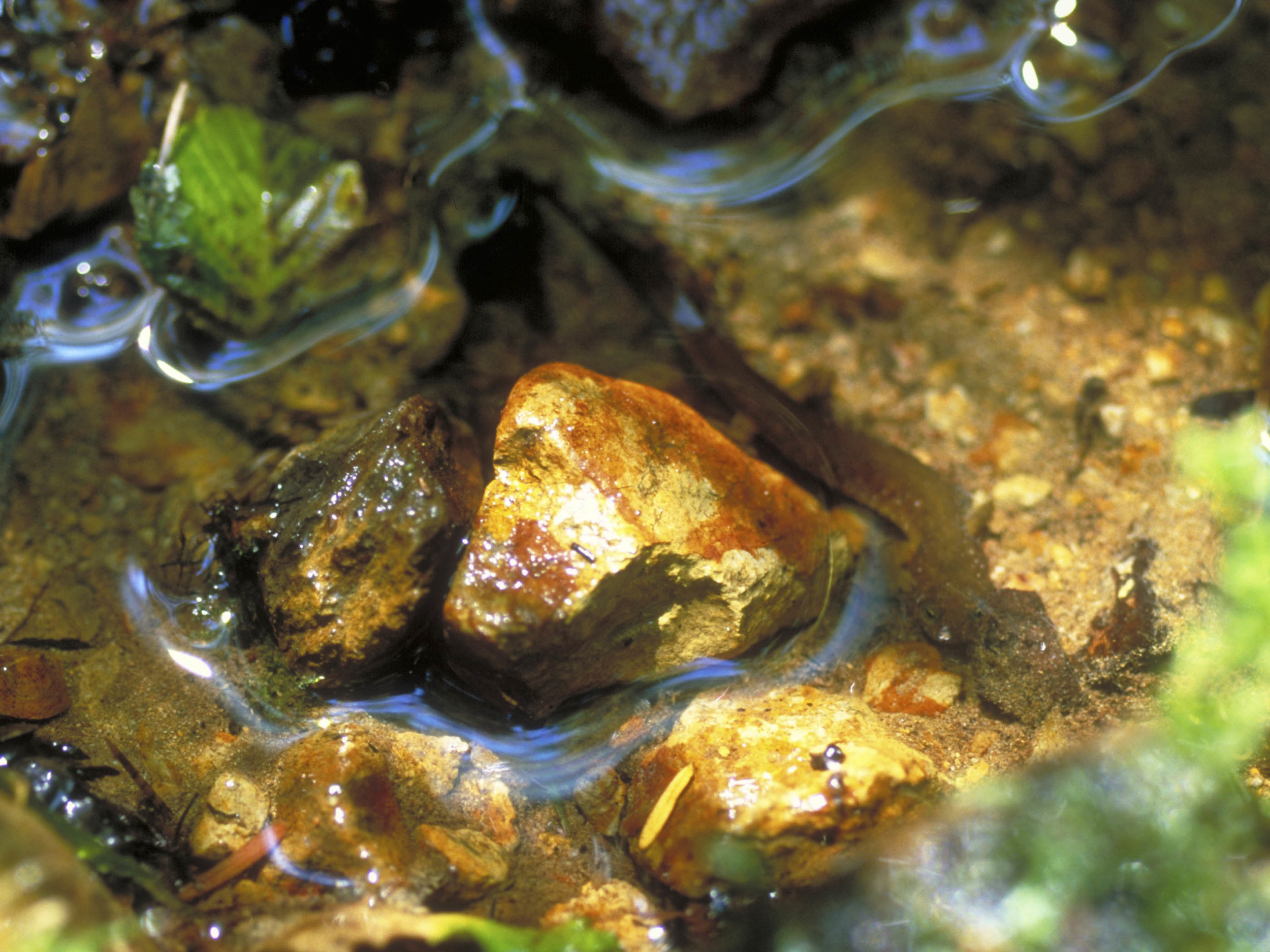
Nestled in the cliffs in Moses Coulee is an import desert water sources that every springs attracts thousands of Pacific Tree frogs. I came to Whisper Lake for a night concert. It was anything but quiet. The chorus of frogs was soothing, calming—the quintessential sound of spring.
The Cle Elum Wildlife Project is improving our understanding of how wildlife use and move through protected forest landscapes, providing us with an opportunity to test how forest management practices impact wildlife and building an evidence base for permanent protection.
World Oceans Day was the perfect opportunity to get outside, enjoy nature and make a difference. We joined our local instagram community by celebrating our oceans and enjoying an amazing sunset along the Washington coast at Ruby Beach. Check out some scenes from the day in the video above!
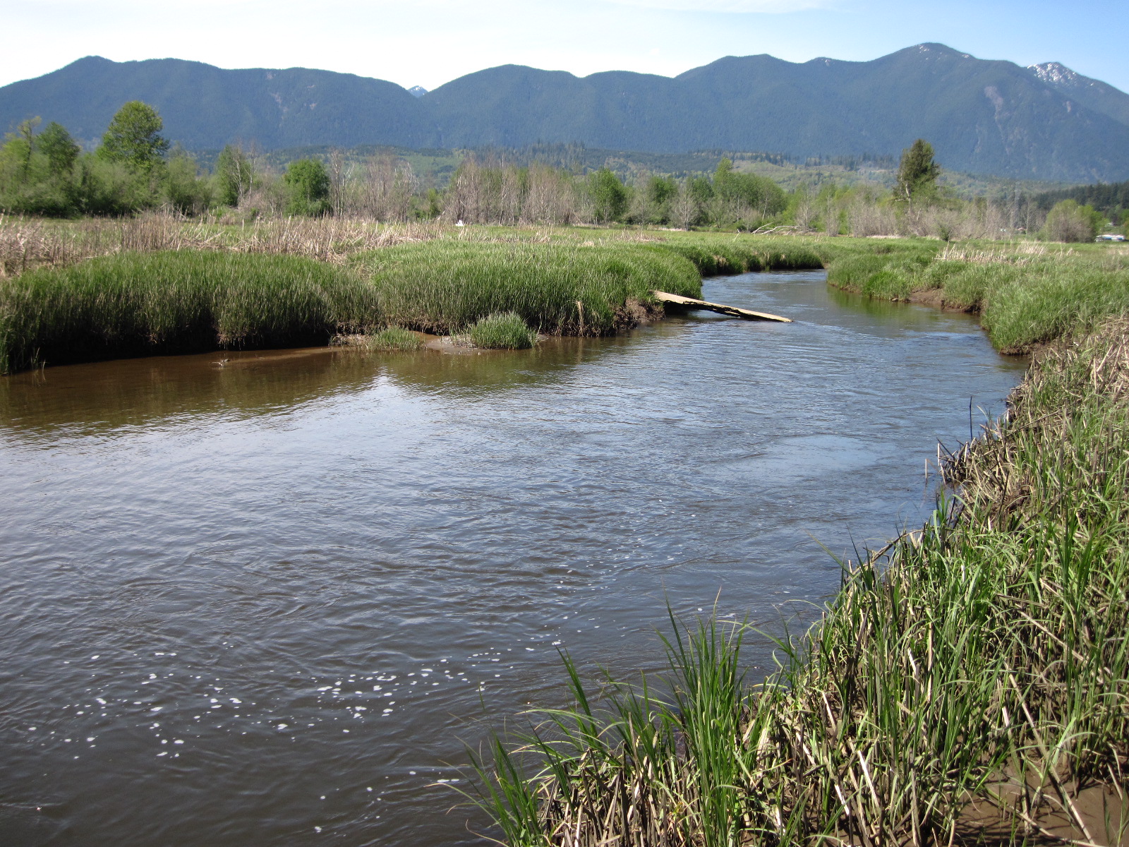
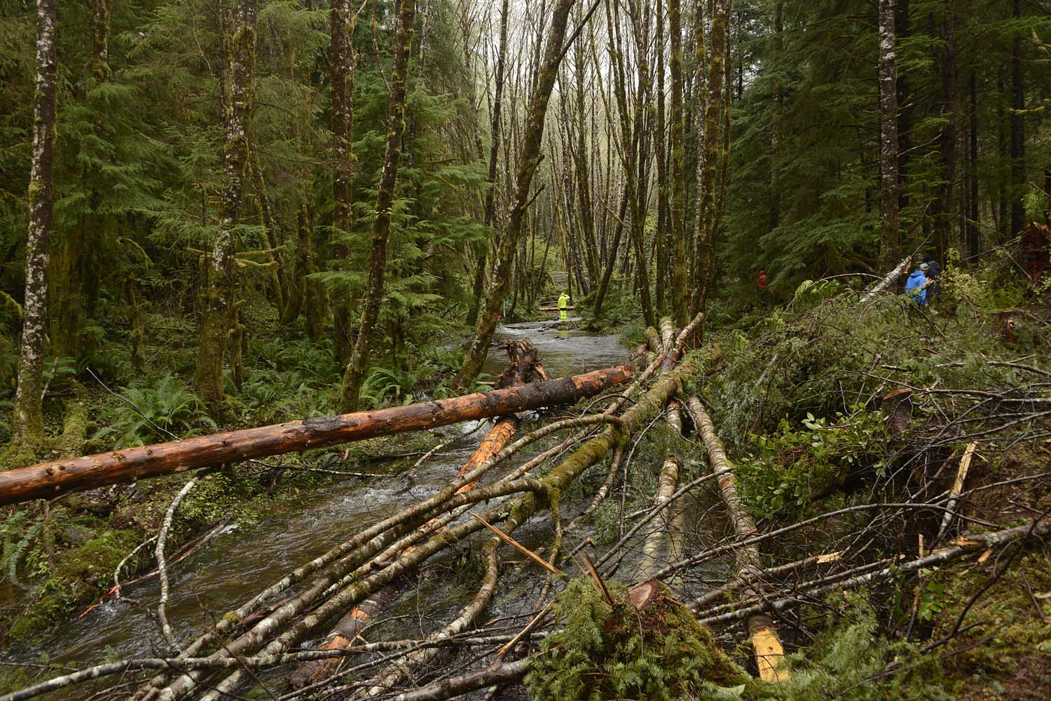
Meandering channels provide important places for young salmon to feed and grow on their way to Puget Sound. (photo credit: Hood Canal Coordinating Council)
The project will provide benefits that are important to the local community. (photo credit: Linda Herzog)
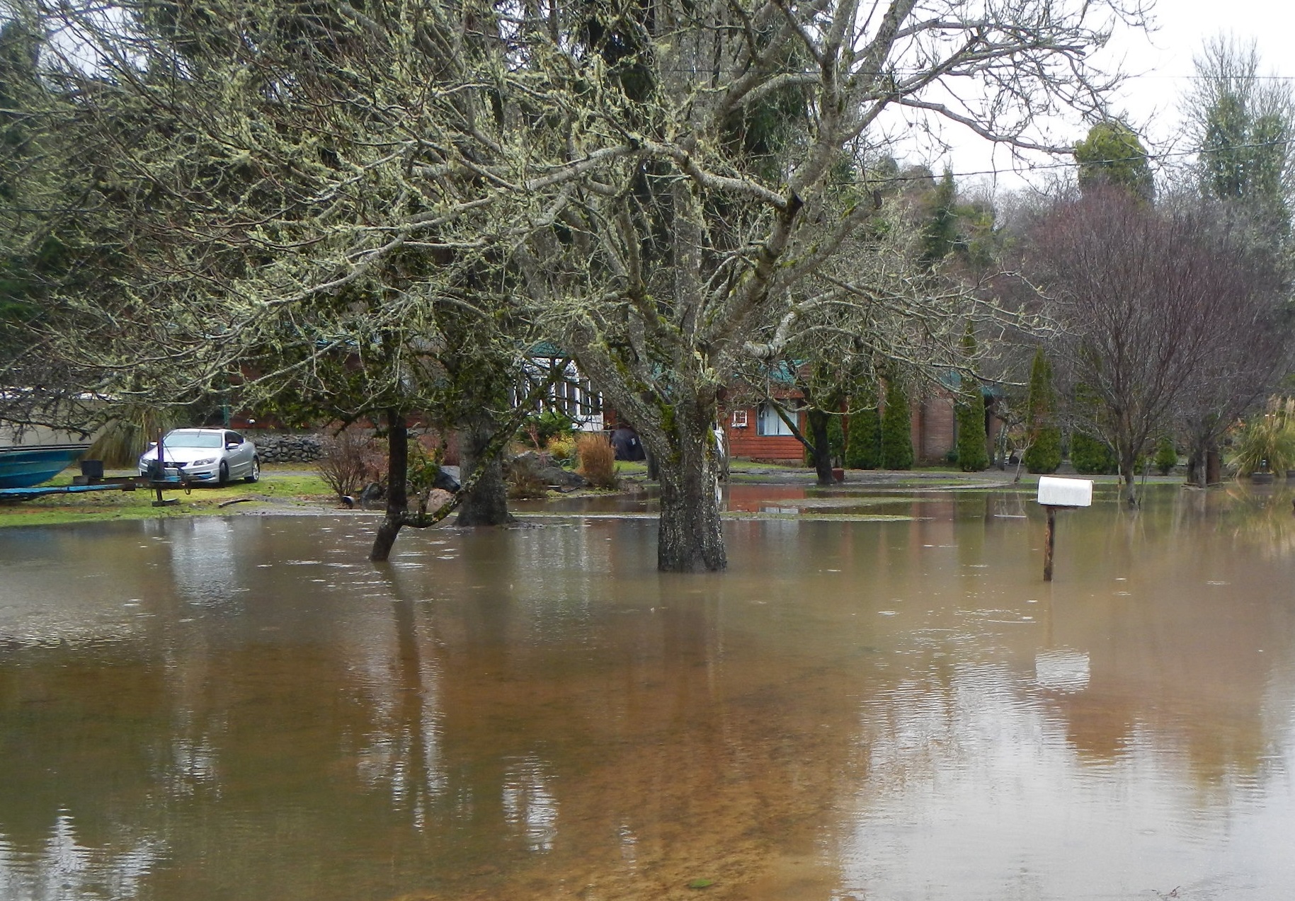
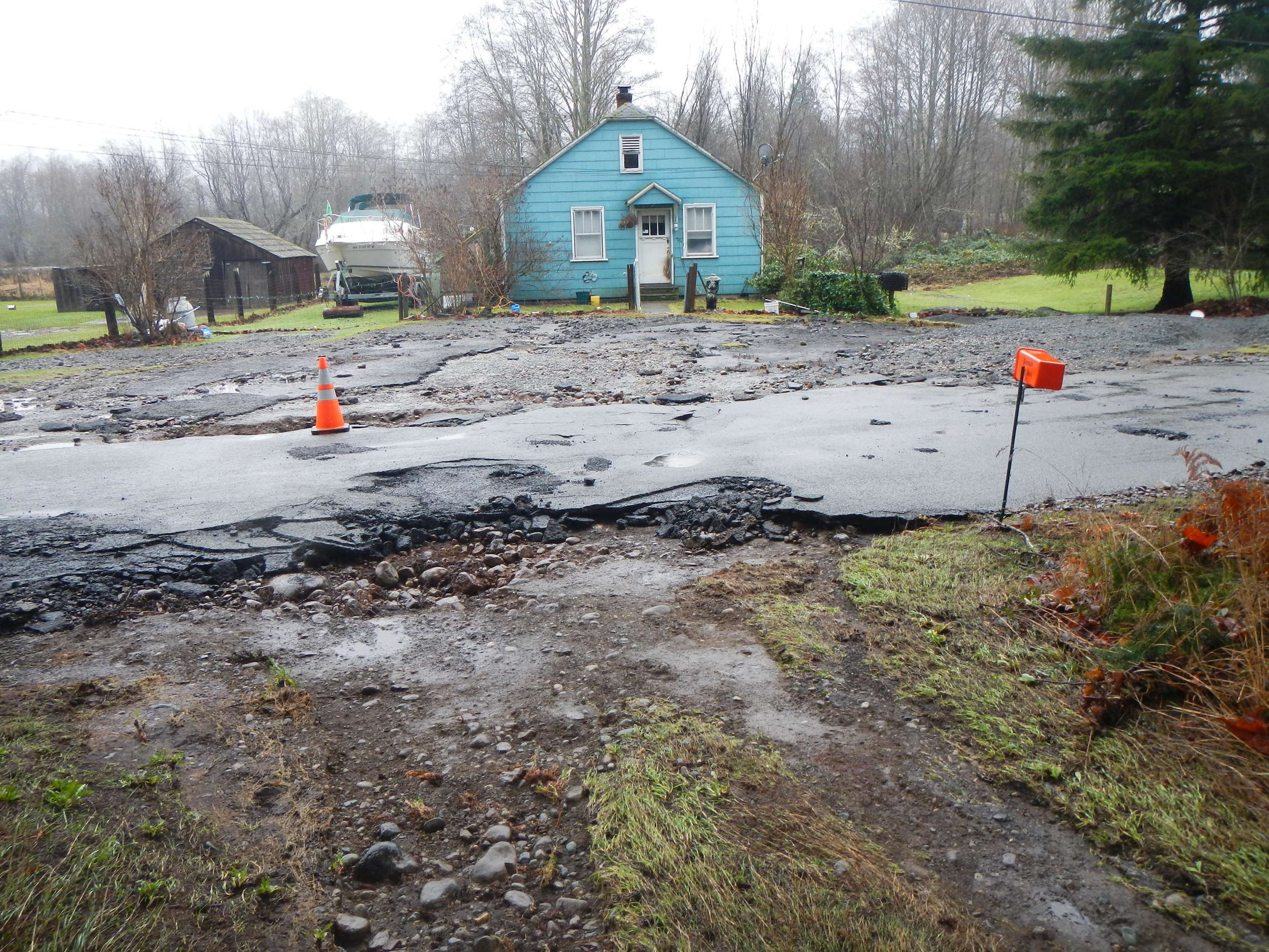
Floods damage roads and homes. (photo credit: Pat McCullough)
Floods damage roads and homes. (photo credit: Pat McCullough)
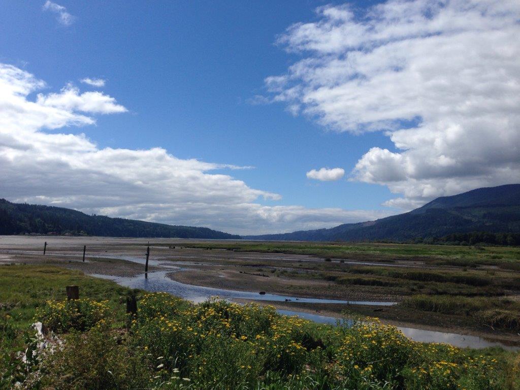
The Big Quilcene estuary is important for salmon, shellfish and people. (photo credit: TNC)
Written by Beth Geiger
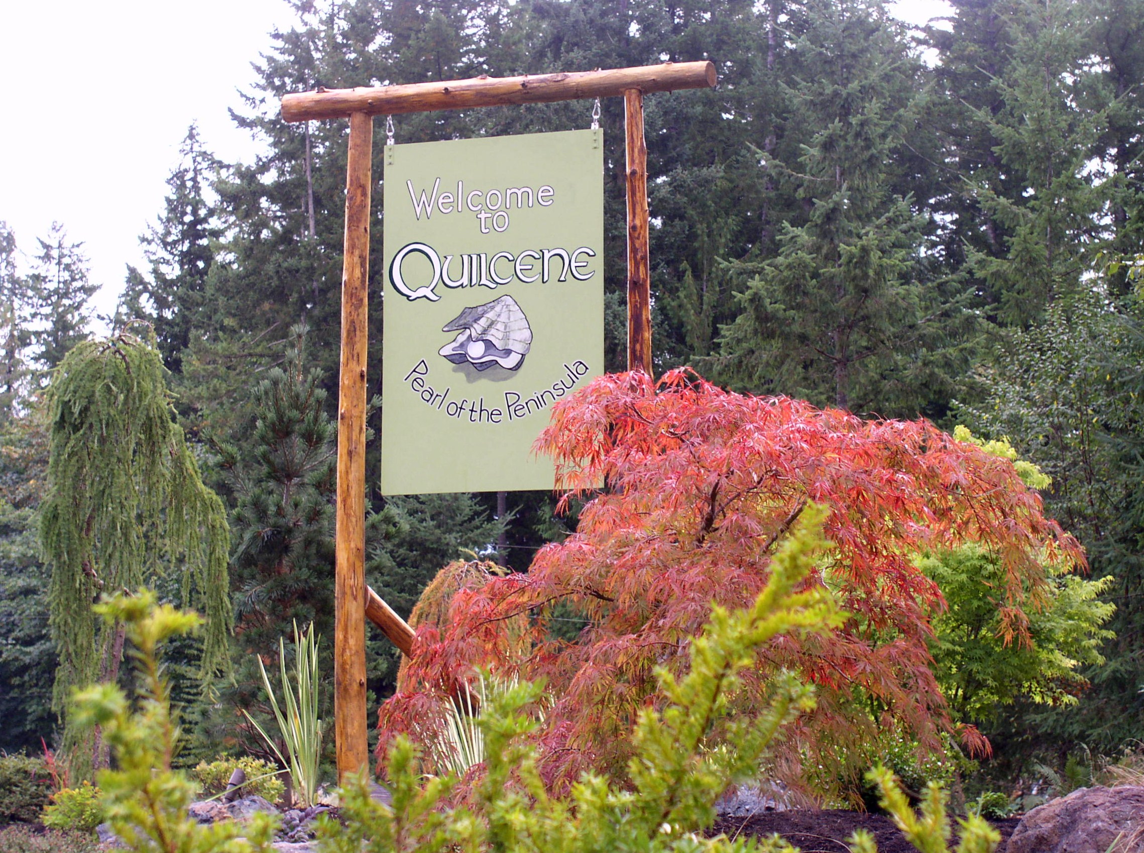
The residents of Quilcene, Washington are used to living close to nature. Logging and shellfish production have long been the core of this small Olympic peninsula town’s economy.
But for some of those residents who live along the Big Quilcene River, flooding may seem a little too natural. At least once every year or two the river rises, swamping about 30 homes. “The flooding is getting more frequent,” says Tami Pokorny with Jefferson County Public Health. “The houses are moldy. People are tired of rescuing muddy kid’s toys from the yard.”
The Big Quilcene also floods sweetly-named Linger Longer Road, which crosses the river. Linger Longer Road is the only access to 70 homes as well as the town’s largest employer, Coast Seafoods Shellfish Hatchery. The hatchery is the world’s largest supplier of juvenile oysters. It operates 24 hours per day so when access is cut off, it’s high impact.
What’s more, the levees extend into the marshy tide flats in the Big Quilcene’s estuary. Removing them may alleviate flooding, but less predictability about where the river channel might go afterwards concerns shellfish producers, whose beds have been successfully cultivated and harvested with the dikes where they are. Meanwhile, habitat for chum salmon in the estuary is also of critical concern. Dikes cut off channels and water flow that link the bay and river and provide important habitat for juvenile salmon.
Community, business, nature: Is there one solution here for all?
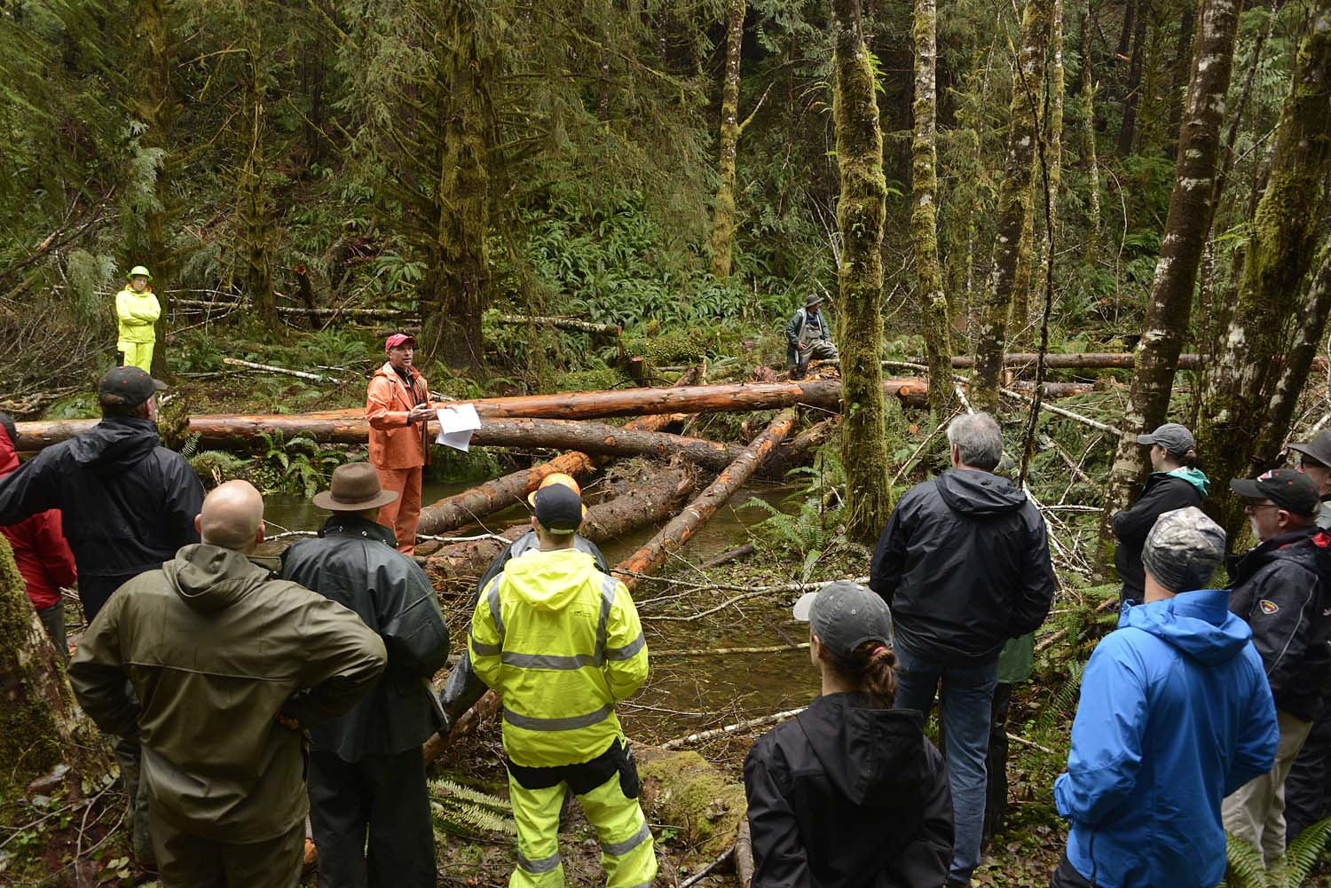
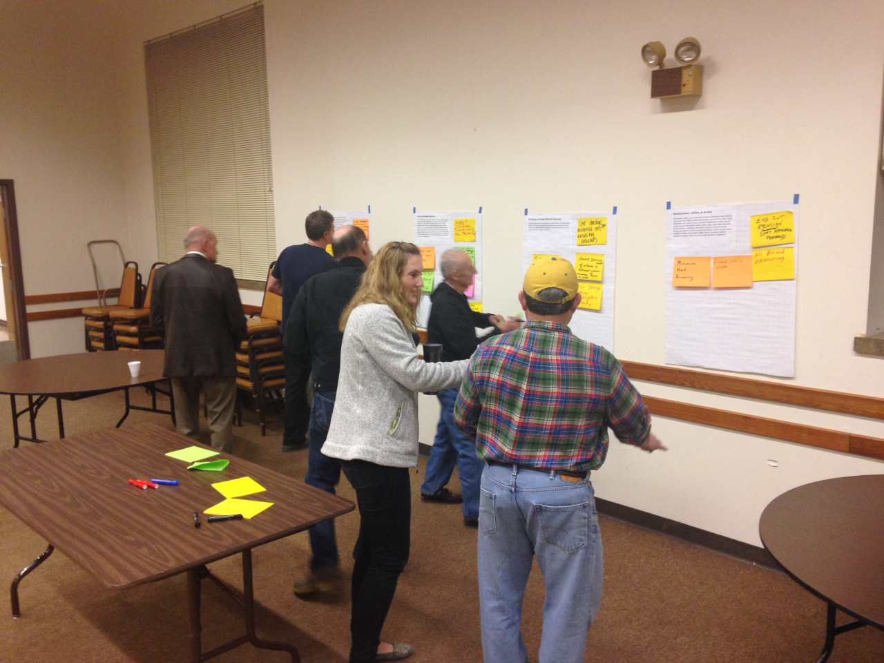
An essential element of the lower Big Quilcene project is engaging community and other stakeholders. The Conservancy, in support of the project lead, Hood Canal Salmon Enhancement Group, and partner Jefferson County, is working closely with key stakeholders in the community to plan the project. Community input has been important in developing the project’s six goals (flood risk reduction, habitat restoration, compatibility with shellfish, educational opportunities, recreational access and economic vitality) and in developing three alternative project concepts. “The thing that stands out about this project is that it’s presenting ideas to the communities and saying “what do you want to do?” says Jared Keefer, Director of Environmental Health and Water Quality for Jefferson County.
The lower Big Quilcene project gives the Conservancy the opportunity to bring skills and knowledge to the table in a strategic, rather than a managing role. The Conservancy provides key support and knowledge to local project sponsors to advance community-supported, multi-benefit projects around Puget Sound. “This is a newer direction for the Conservancy,” says Jenny Baker, restoration manager for the Conservancy. “By playing more of a strategic role, we can have a bigger impact over a larger area.”
Written by Tom Parker, Northwest Photographer
Little Qualicum Falls is one of my favourite stops when I'm headed north on Vancouver Island. Located near the centre of the island it has a great mix of lush forest greens and sparkling waterfall blues packed into a beautiful 1km loop. With the river always fluctuating throughout the seasons the landscape is constantly changing, creating new scenes each time I visit. In the winter months the river has so much power that it is constantly shifting massive fallen trees down the banks, sometimes creating natural bridges or leaving them in precarious spots for viewing such as hanging from the tops of waterfalls.
On this day my friend Forest was in town and wanted to see the island, so we headed down the Alberni Highway looking for adventure with our first stop at the falls. When I was shooting the river Forest had disappeared and the next thing I knew he was climbing across the logs making his way over the river. Its always inspiring to go exploring with friends that are not afraid to leave their comfort zone. As a photographer I’m always looking to push new boundaries, personally and with my work.
Nature inspires my photography in many ways, from the slowing of time to the roar of the rivers washing away distractions, allowing my creativity to flow. When I am out in the woods it is as if time stands still, very little seems to affect me; the cold, the wet or the feeling of hunger drift to the back of my mind and all I focus on is the present. With the weather always changing on the island my favourite hikes rarely look the same, always providing a fresh perspective. It also means that to catch these sudden changes in weather I try to be outside as much as possible. The light and fog may only be around for a few fleeting moments but sometimes thats all you need.
Born and raised on Vancouver Island, Tom has spent most of his life exploring the outdoors. His work is inspired and influenced by the beauty that unfolds before him in nature. Follow him on Instagram: @tomparkr. Visit his website: tomparkerphoto.com
Written and Photographed by Tricia Sears, Julian Lawrence, and Megan Fishpool
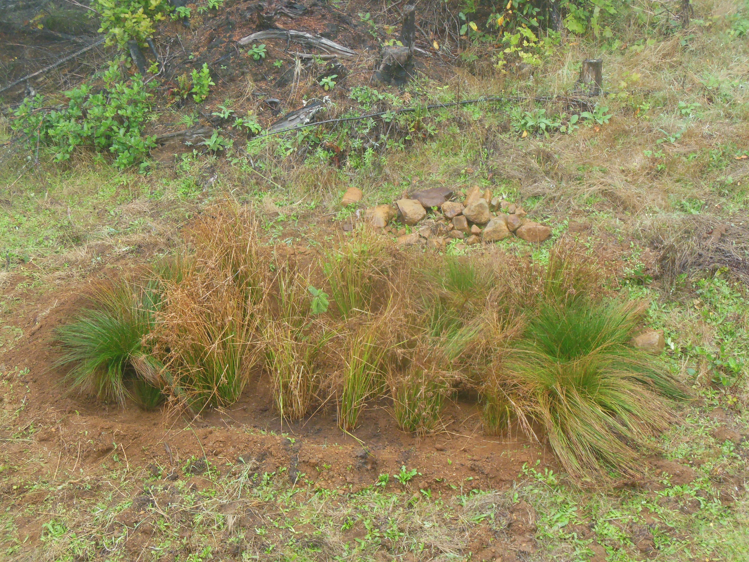
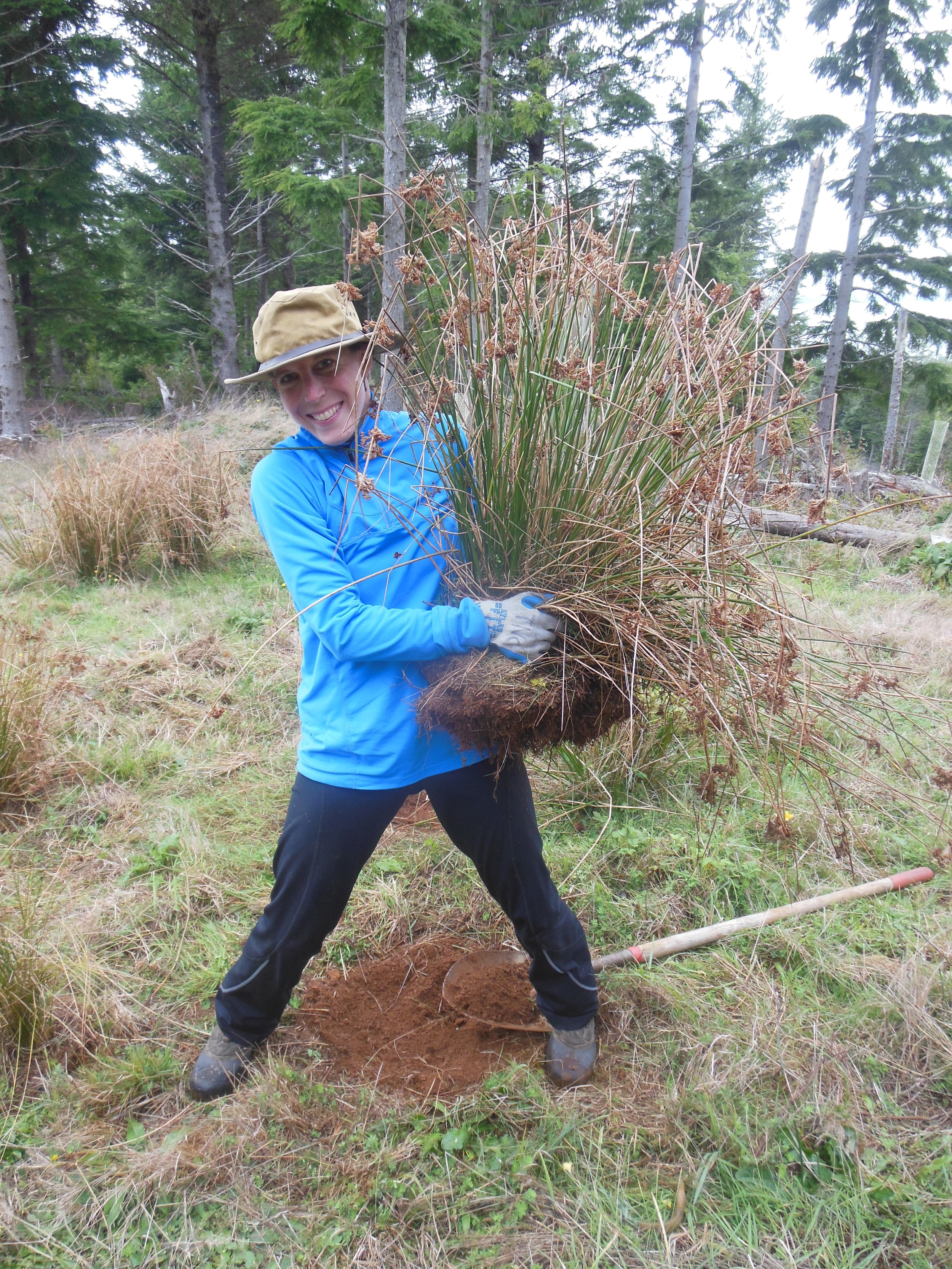
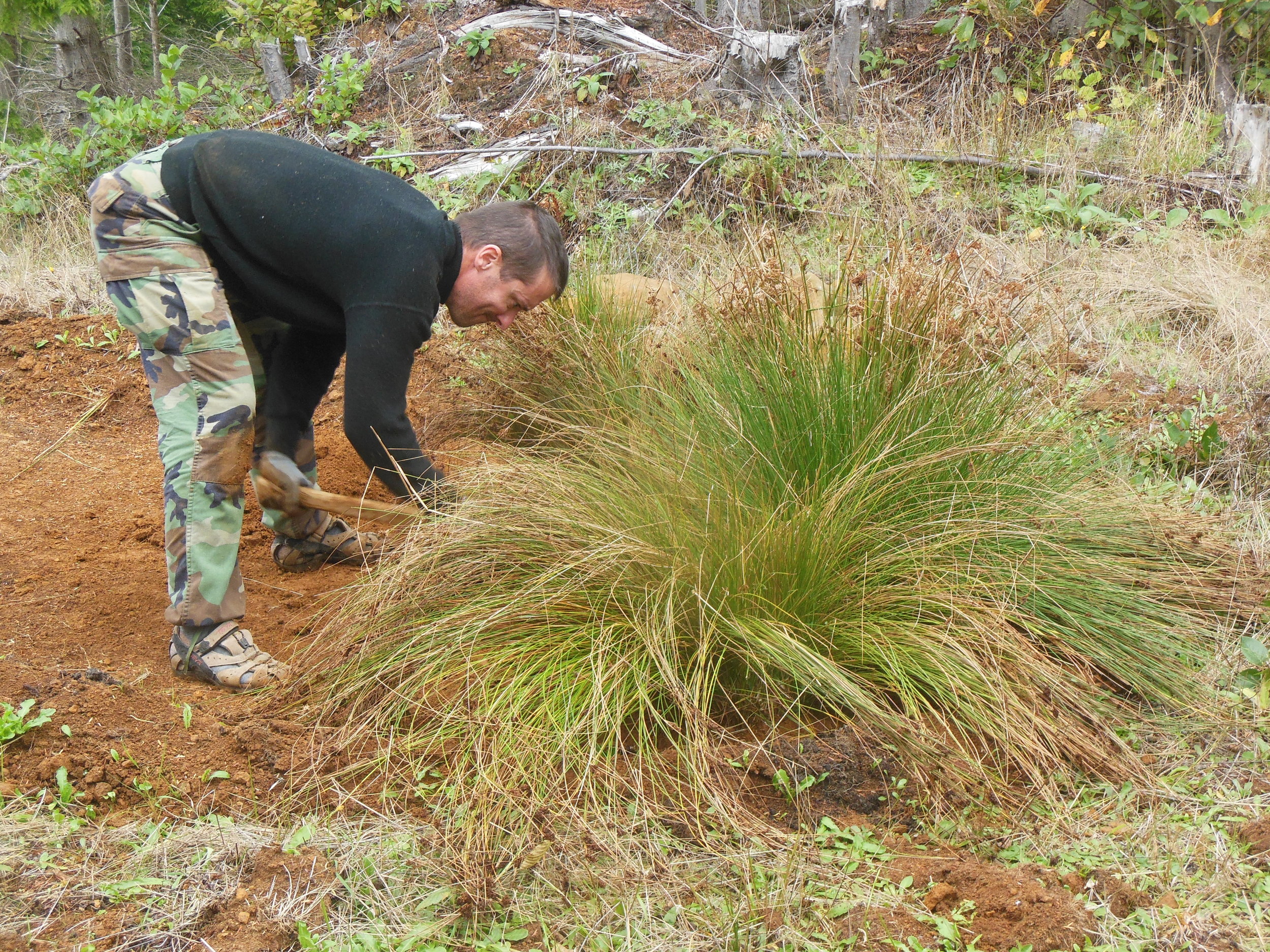
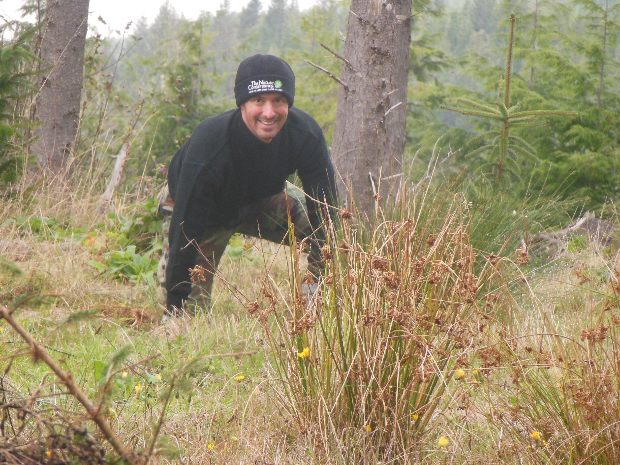
We have volunteered for The Nature Conservancy, doing projects on the Ellsworth Preserve, for five years. Therefore, we are very familiar with the frequency and intensity of the rain in this area. Ellsworth Preserve is a thriving and beautiful landscape - logged and reforested over many years. There is a small building on a hill at the elevation of 800 ft. that receives over 100 inches of rain per year. The large amounts of rain in this area can cause erosion. To help alleviate erosion problems, we wanted to provide a better method for water to infiltrate into the soil. Being familiar with rain gardens, we were inspired to construct a rain garden by the small building.
Over the course of four days in October and November 2015, we dug the 15 ft. x 6 ft. rain garden out. We then installed small and large well rooted plants so the rain garden would be immediately functional. The plants, known as the common rush or Juncus effusus, were transplanted into the rain garden from an area adjacent to the small building. We also planted one sitka spruce, Picea sitchensis, in the rain garden. The small building has a water tank and its overflow is now directed to the rain garden using old gutters stabilized by strong support branches and cairn style rocks. Since we constructed the rain garden in heavy rain, the immediate effectiveness of the rain garden was clearly demonstrated as it quickly handled large amounts of water!
Written by David Ryan, Field Forester
Photographed by Larry Workman, Quinault Indian Nation
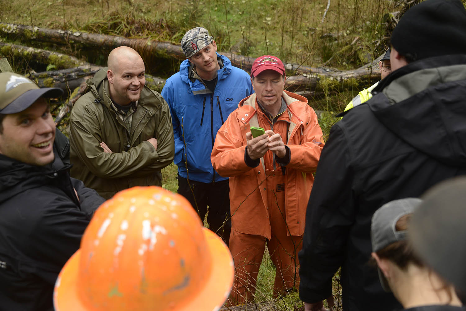
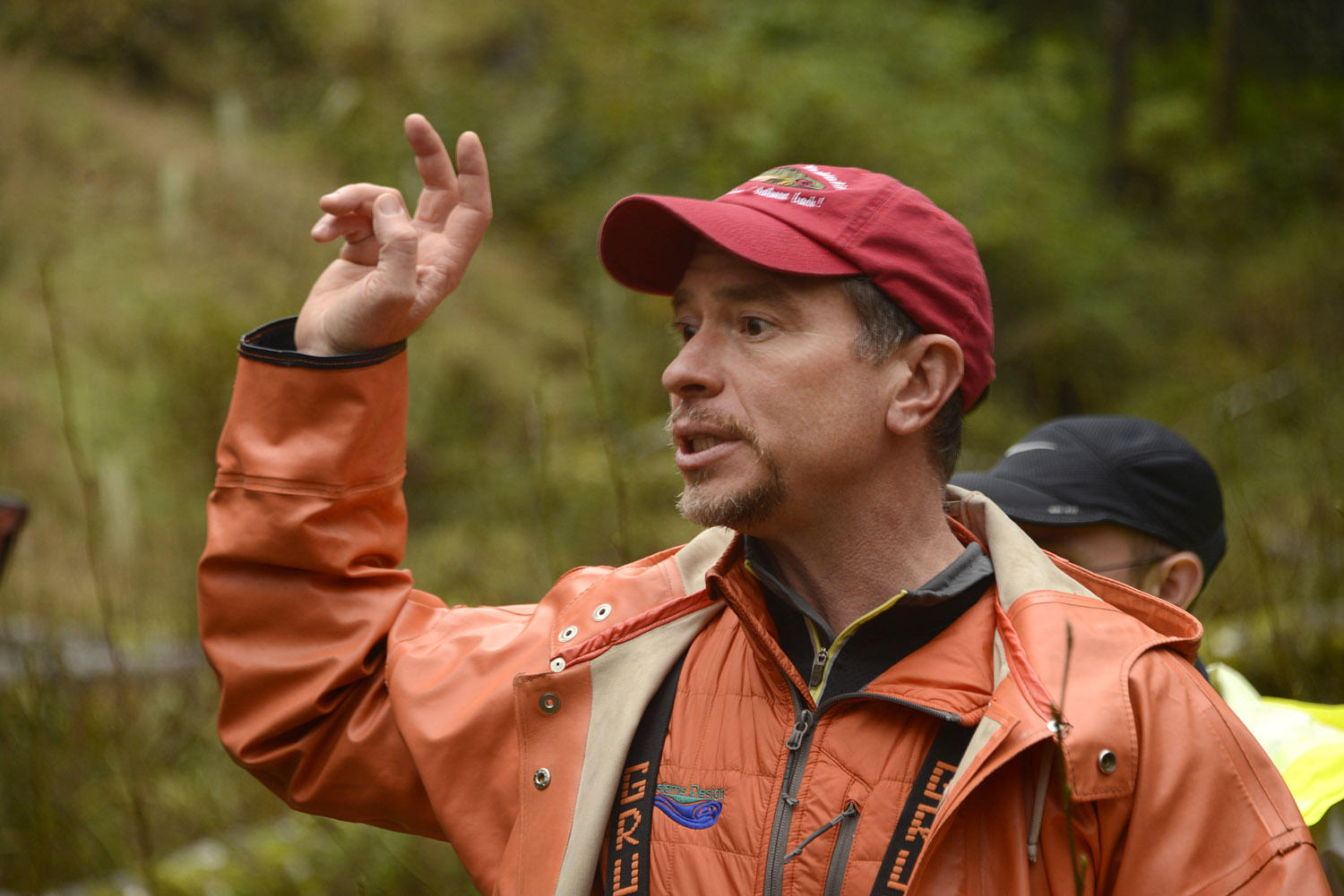
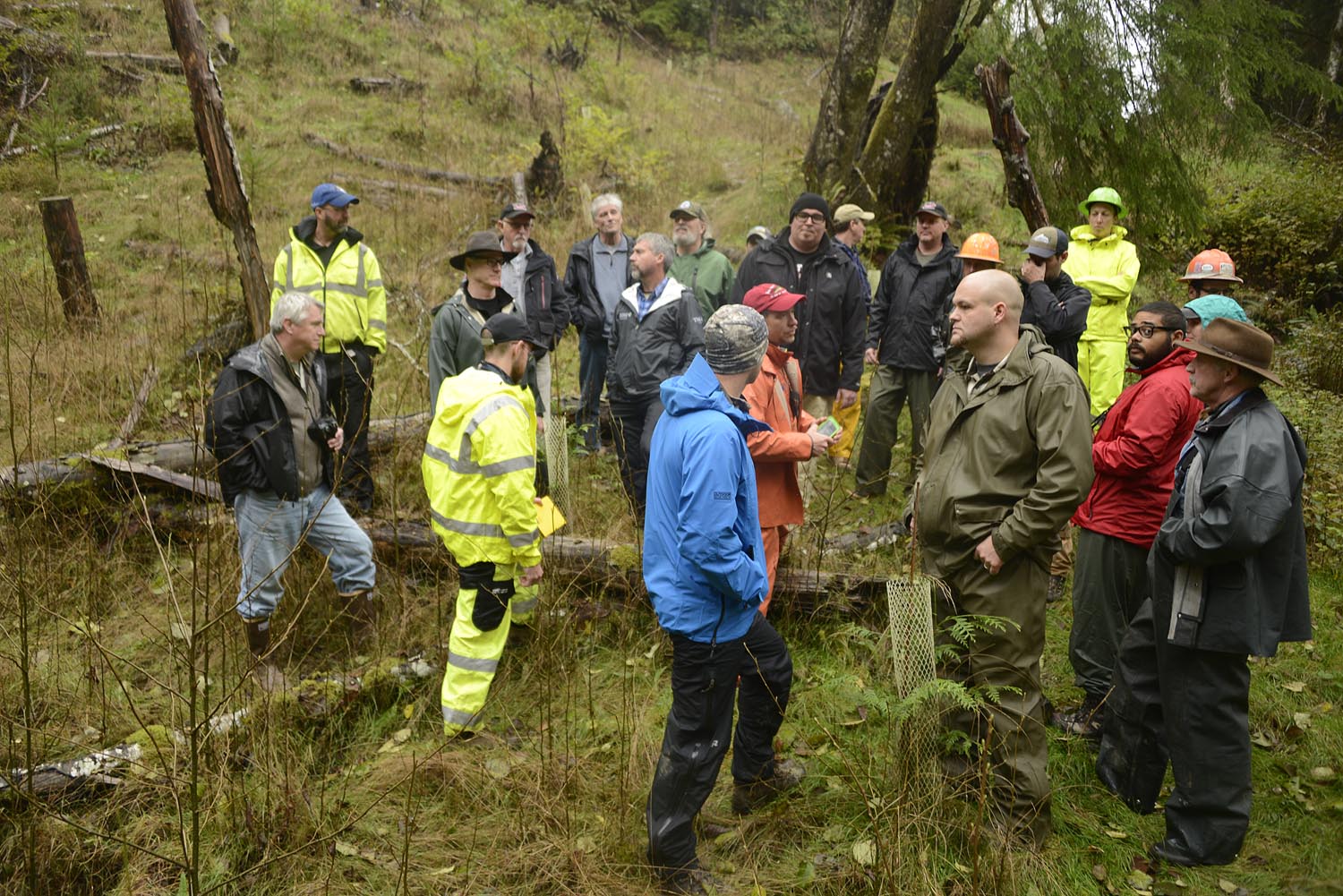
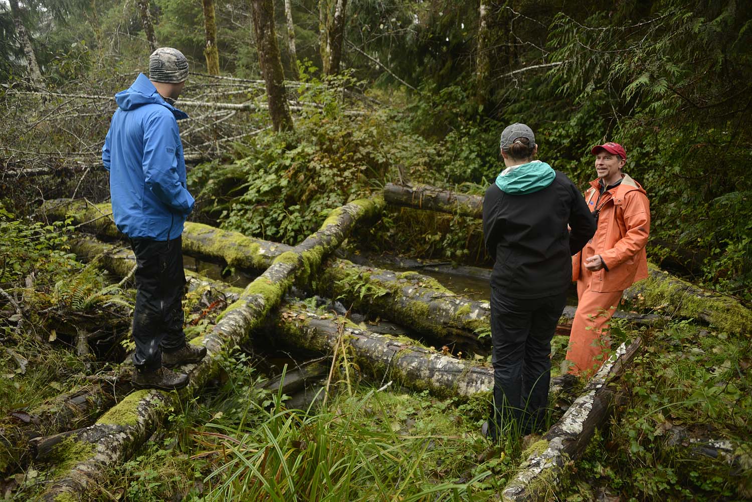
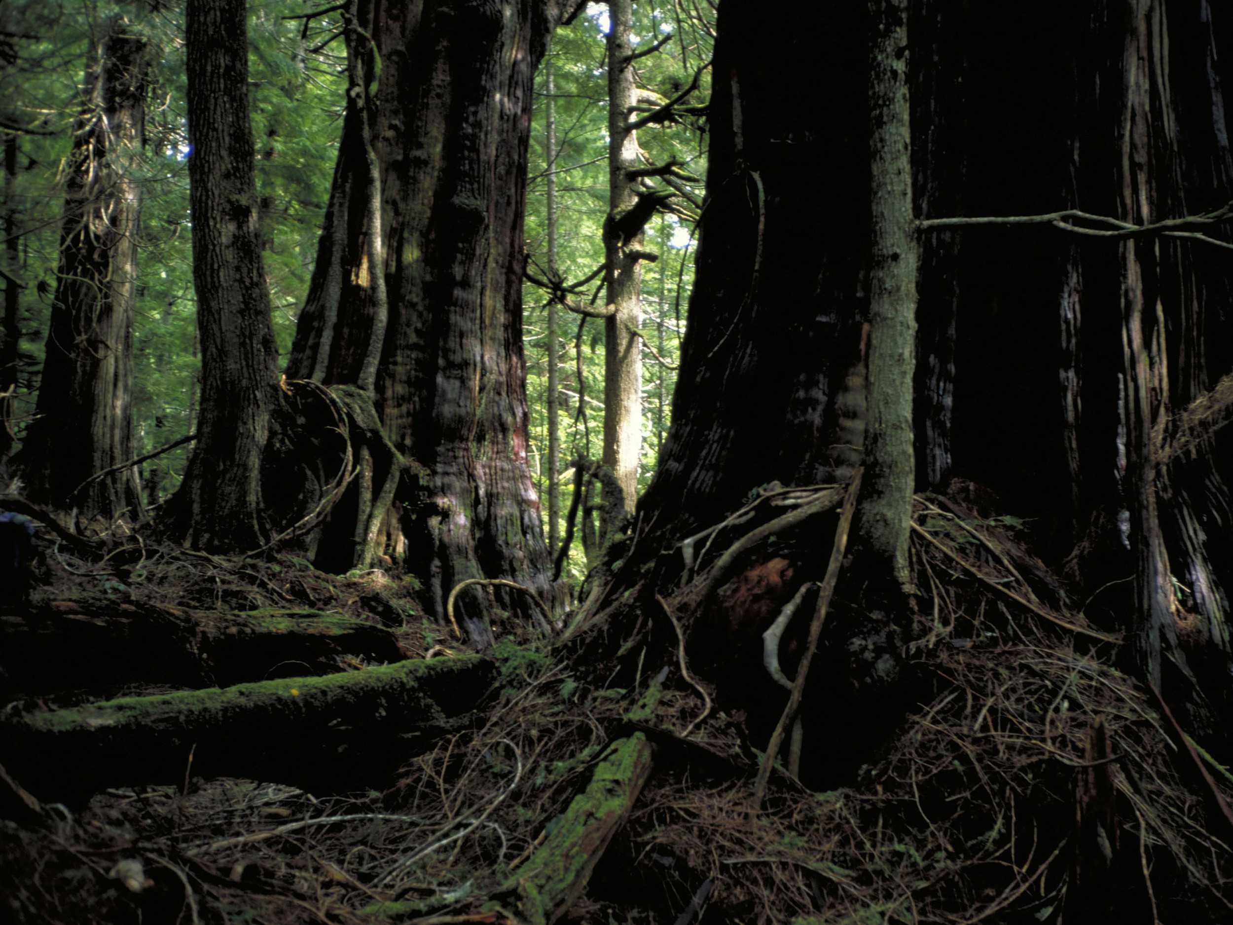
We are standing in a creek bottom with water around our feet. It’s raining. It’s cool, but not too uncomfortable. As the old saying goes: “There’s no such thing as bad weather; just bad clothing.” I am fortunate that my guests seem to understand that. My guests are several members of the Quinault Nation and the Bureau of Indian Affairs.
They are here to look at the work we are doing at Ellsworth Creek Preserve. This year we have decommissioned roads, upgraded roads, implemented a forest restoration thinning, and worked on an in-stream restoration … among other things.
As a field forester for The Nature Conservancy one of my duties is to participate in meetings, tours, and workshops pertaining to forestry and ecology. I thoroughly enjoy when those events are held at Ellsworth Creek. I love meeting people who are interested enough to visit and look at the forest and I always learn every time guests arrive.
As a temperate, coastal rainforest Ellsworth can be a challenging place to visit. It is steep. It is brushy. It is wet. Those logistical challenges increase when coupled with management activities on the landscape. Again, I am fortunate that my current guests understand that as well. They are game for inclement weather, rough ground to walk over, and heavy machinery to coordinate around.
The rewards are rich. We visit log jams installed this summer that are already re-engaging historic floodplains and channels. We look at forest stands that were recently managed, historically managed, and others that will not see human management again. We checked roads that no longer exist due to our work. And most importantly, we talk. We discuss. We question. We answer… or we don’t. We think critically. We don’t always agree. One course of action here may or may not work for other land managers elsewhere. But the discourse is always respectful. And we all seem to enjoy the conversation.
We have now spent many hours walking, talking, and wending our way through the rain and the woods; certainly a physically uncomfortable day for many people. Eventually a discussion arises of whether people want to continue downstream to look at some bigger log jams and another forest stand treatment or go back and get warm and dry. I hear a colleague call out for “a coalition of the willing to venture further downstream” to continue the discussion.
Almost everyone walks downstream. The conversation continues. I am grateful when people take the effort to really look at our work. I am grateful for my guests. And this place.
Written by David Ryan, Field Forester, Willapa Bay
“Conservation is the foresighted utilization, preservation and/or renewal of forests, waters, lands and minerals for the greatest good of the greatest number for the longest time.”
This famous quote of our first U.S. Forest Service Chief is regularly heard by any student of forestry or natural resource management. In my mind, this statement primarily encompasses two philosophical concepts of natural resource management. First, that our forests, waters, lands and minerals are essentially resources to benefit humankind. Second, for these resources to benefit humankind they must be managed in a way that will not deplete them over time, i.e. sustained yield. Pinchot’s philosophy put him at odds with preservationists such as John Muir, with whom he shared a friendship until a disagreement over the Hetch Hetchy Project created a permanent rift. Other conservationists, such as Aldo Leopold, would refine, and in some ways reject, Pinchot’s utilitarian conservation philosophy.
Treating our forests as if they were agricultural commodities has led to some silviculture practices which may reasonably be considered questionable, e.g. terracing. Practices that were meant to increase the productivity of a landscape often altered the natural succession, or ecologic pathway, of many forests. These foresters were not malicious, nor were they necessarily incompetent. They believed in what they were doing; that increased forest productivity was a benefit to the people and to the landscape. For them, utilitarian based land management was not only good for the economy and their communities, but for the forests as well. I have found myself using the similar utilitarian arguments while explaining my own management actions.
Ellsworth Creek Preserve is a landscape whose succession was altered from its natural, original, unmanaged course and put on an artificial trajectory consisting of simplified, essentially monoculture forests. The ramifications of these stands continuing on that artificial course are homogenous forests with limited biodiversity and limited ability to recover to their original successional state. I now have the honor of trying to help this landscape recover and restore it to an old-growth trajectory. In so doing I also have the honor of being a member of the community that surrounds Ellsworth Creek Preserve and to help that community in the form of good work and positive economic activity.
Ellsworth is an example of a working forest. In the past it was a working forest under industrial style management with a primary goal of economic returns based on an agricultural model. Now it’s still a working forest, the main purpose of which is not one of anthropocentric utility but environmental health based on an ecosystem restoration model. Under this model, we are still putting people to work. In the few short months I have been at this preserve, I have worked with many men and women in the interest of furthering Ellsworth’s goals. One may reasonably say that the forest ecosystem itself is “working” to create a diverse and healthy region; and with the help of these working men and women, this forest will continue to do so for many generations.
Helping create a healthy ecosystem and a healthy community feels like the “greatest good of the greatest number for the longest time” to me.
Next week: Aldo Leopold.
Bringing Back Wild Salmon
Photos and Video Recording by Kyle Smith, Washington Forest Manager
Video by Cailin Mackenzie, Globe Intern
Narration by Lauren Miheli, Volunteer Coordinator
The Nature Conservancy worked with the Quinault Indian Nation and other partners to install six engineered log jams on a tributary of the Clearwater River. Kyle Smith, our Forest Manager, relocated fish from the stream to protect them during construction. In the late 1970’s and early 1980’s, many northwest streams were completely logged – log jams restore the woody debris salmon need. This project helps reach our restoration goals for the nearly 10,000 acres of Olympic land and water we protect.


Written & Photographed by Bob Carey, Director of Strategic Partnerships
The China Coastal Wetland Conservation Network hosted its first workshop earlier in June in Chang Le, Fujian Province China. The workshop focused on the wetland ecosystems and the ecosystem services they provide in the coastal provinces of China – a region which supports 50% of the national population and 60% of its economic activity. Workshops like these are critical as these areas of the coastal wetlands have decreased by 22% in the last decade. The workshop’s purpose was to launch a new learning network of scientists and conservation practitioners to inform wetland conservation efforts across China’s extensive coast.
As a Strategic Partnerships Director and through the Conservancy’s work in Puget Sound with Floodplains by Design and other coastal conservation projects, I was invited by The Paulson Institute to speak and contribute to the first workshop of the China Coastal Wetland Conservation Network. One of four invited international experts, I shared my expertise in restoring coastal habitats and using wetlands as natural infrastructure to lessen storm and flood risks to local communities here in Puget Sound. And I drew from the experience the Conservancy has gained working in other coastal areas of the US, including the Mississippi River delta and Chesapeake Bay. Given the thousands of acres of tidal marshes along the Chinese coast that have been impacted by invasive Spartina, I was also able to share the successful experiences the Conservancy has had in working with conservationists, agencies and shellfish growers to battle Spartina in Willapa Bay and Puget Sound.
The eastern China coast and Puget Sound have more in common than you might think. Both areas of part of critical flyways that support hundreds of thousands of migratory birds annually. And birds on both coasts have experienced significant declines. Chang Le, like Seattle, Tacoma, Olympia and other cities in Puget Sound, is located along the coast and near the mouth of a river – in this case the Min Jiang. As in Puget Sound, coastal China is the hub of its population and its economy – people tend to cluster along waterbodies and waterways, putting pressure on coastal wetlands and ecosystems. As a result, wetlands in China (and in Puget Sound) have been lost or degraded due to diking, draining, filling, water pollution, and invasive species. The environmental similarities between Puget Sound and the Chinese coast provide a valuable opportunity to share lessons learned.
Habitat loss, water quality degradation and invasive species are all prime examples of how environmental issues defy borders – productive international cooperation is crucial as we work together to protect nature. It also provided a great opportunity to visit our global program and see the Conservancy’s China office! This was an amazing experience and I was honored to share expertise at the China Coastal Wetland Conservation Network’s workshop, and continue to develop these important international partnerships.
Learn more about Floodplains by Design.


Photograph by Bridget Besaw
WASHINGTON COAST – The Nature Conservancy has sold 1,720 acres of forestlands above the Queets River to the state Department of Natural Resources for management within the Olympic Experimental State Forest as wildlife habitat and working forest.
“This sale assures our conservation goals for this property, and supports the Conservancy’s long-term goals of a sustainable Olympic rainforest that supports wildlife and the local economy,” said David Rolph, Washington’s Director of Forest Conservation and Management for the Conservancy.
The property was part of 2,321 acres the Conservancy purchased from Rayonier in 2014. Conservancy analysis showed that the 600 acres closest to the river is most important for salmon and the health of the river system. The remaining 1,720 acres, while important upland habitat, could be managed in ways that includes sustainable forestry and some logging.
By selling to the Department of Natural Resources, the Conservancy is ensuring good long term management of the land, Rolph said. DNR owns most of the surrounding land, and their management in the Experimental Forest is governed by a 70-year federal conservation plan. It ensures strong protection of wetlands and the development of older stands of trees in the forest rotation. It also allows for continued public access and recreation, and revenue to the state school trust
“Analysis from our scientists confirms that DNR’s management under their federal conservation plan can be a good match in supporting the Conservancy’s habitat restoration goals along the Queets River system,” Rolph said.
“We’re grateful for the partnership with The Nature Conservancy in purchasing this land,” said Commissioner of Public Lands Peter Goldmark, who chairs the Board of Natural Resources, which authorized the purchase. “It will benefit future trust beneficiaries and DNR’s conservation commitments on the Olympic Peninsula.”
The sales agreement was announced in April, when the Board of Natural Resources authorized the $5.2 million purchase. The sale closed June 12. The Conservancy will use the money generated by the sale, for further forest conservation work.
The Queets is one of four major rivers flowing from the summit of the mountains in Olympic National Park to the Olympic National Marine Sanctuary in the Pacific Ocean. The Conservancy has also purchased and is restoring forest lands on the Clearwater, a tributary to the Queets, and on the Hoh River farther north. The Conservancy is also working with the Quinault Indian Nation for restoration of forests on the Quinault River.
Together with the acquisitions on the Clearwater and Hoh rivers, the Conservancy is now managing 9,410 acres of forest lands in Jefferson County. Conservancy foresters and ecologists have developed long-term plans that include planting trees, restoring important salmon and wildlife habitat, and sustainable long-rotation timber harvest where it makes sense.


Protecting the Little Guys (Because they’re so tasty!)
Story by Paul Dye, Director of Marine Conservation
Photography by Erika Nortemann
The Pacific Fishery Management Council—the body that creates fisheries regulations for federal waters off the West Coast—did a wonderful thing this week. They declared a large number of fish and squid species off limits to targeted fisheries until we know what the impacts of a new fishery would be. All of the protected species are small, and they’re known as “forage”species because so many other animals eat them. They provide a vital link in the ocean food chain that starts with sunshine and algae and tops out with fresh fish on our menus. The new protections will help ensure that seabirds, whales, seals and sea lions, and the bigger fish that people typically catch and eat will all have a healthy and sustainable food supply.
I have been pleased to play a small part in this innovative example of ecosystem-based fishery management. I chair the Council’s Ecosystem Advisory Subpanel—a group of volunteers representing the people of Washington, Oregon and California who care about the sustainability of our fisheries and the health of the ocean. Some of us are scientists, others are commercial or recreational fishermen, conservationists, or have retired from one of these fields. Over five years, most of the work to develop the new management measure fell to fisheries scientists and policy experts working for government agencies. Our subpanel ensured that a broader range of perspectives guided that work.
The new measure has attracted nearly universal support from commercial and sport fishermen, the seafood industry, retailersand restaurants, and environmental groups. That is a good sign that we are getting smarter about how to use—and conserve—our ocean resources.
Read the full story on EarthFix!
You can learn more about our marine work.
Related Blog Posts


Story and Photography by Andy Porter
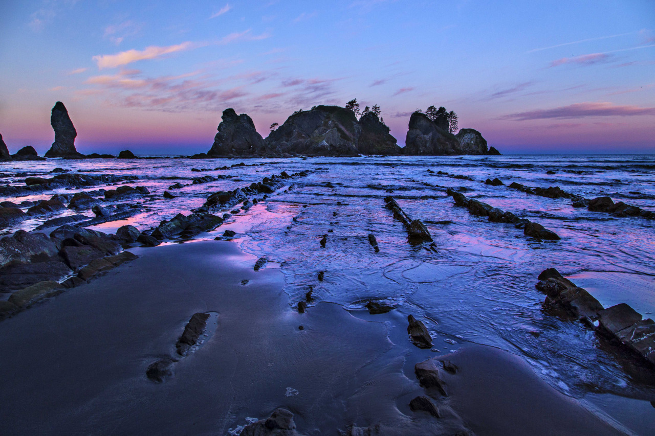
Washington boasts some of the most pristine and untouched coastline anywhere in the lower 48. I normally associate wilderness with the mountains or desert southwest, but here, in Olympic National Park, the beaches are sublime.
Wide sand beaches separated by jagged headlands that cutoff small sections, sea stacks jutting out of the ocean just off shore, forests of driftwood thrown up like matchsticks along the beach, there all make for a fantastic place to hike and camp.
My favorite stretch of Washington coastline is called Point of the Arches. Here you can camp along the water’s edge, and soak in all the air and surf you like. I plan my trips here based on the weather forecast. I have spent many nights here in the cold rain and now have become more of a fair weather visitor. Last week was one of those golden windows, a three day forecast for warmer temps and sun…and in February!
I made my way out to the Olympic Peninsula and finally down to my favorite spot, right in front of the sea stacks and tide pools. Capturing images seaside demands a good amount of luck. The light mid-day is harsh and unforgiving. For this reason I almost never do any day hiking, but rather make the trek in with all that I need to spend a night or 3 and bask in all the glory of wilderness and sea.
I was lucky again. The afternoon shadows lengthened and the light came alive. The glow of the fading sun lit up the rocks and sand.
As the golden hour progressed the colors became more magical. Things could not be better! Late night brought stars and the glow of ships and nearby settlements.
The following morning the sunrise crept up, and then pounced on the shore. The soft colors, like a pastel artist’s image, are so smooth… Luckily I was ready and able to capture a few images before the sun crested the horizon.
Most of my images were captured with a 14mm lens. I also carry a 24-105mm lens, but love the detail and depth of field from the wide angle lens. Make sure to bring a few memory cards, you’ll need them!
Andy is a nature photographer lured to Washington State by the glorious vistas. He lives along the North Cascades Highway, where he teaches photography and leads photo tours. You can see more of his work at: www.AndyPorterImages.com
Did you know? In the late 1970s, Portland heiress and sculptor Marie Louise Feldenheimer wrote a $500,000 check to enable The Nature Conservancy to buy Point of Arches, on the Olympic Coast. When the Conservancy sold the property to the Olympic National Park, the proceeds helped to establish the Land Preservation Fund, a Conservancy revolving fund for acquisitions around the world.


Enjoying & Protecting the Sea
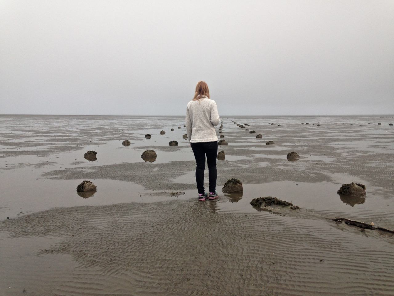
Story and Photography by Molly Bogeberg, Marc Hershman Marine Policy Fellow
Much of our time as a marine team is spent traveling the coast to meet stakeholders in their communities. Right now, we are working with local shellfish growers, fishermen and citizens who care about their coast in Pacific and Grays Harbor Counties. We are finding that their goals for the coast are not so different than our own; to promote the protection of marine habitats, species, and resources.
We are assisting Pacific County and Grays Harbor to become the first counties in Washington to establish environmental designations in the marine waters to ensure no net loss of their ecological functions through the Shoreline Master Program (SMP). Updates to local SMPs allow counties to create policies and regulations within their shoreline jurisdiction. These two counties are highly dependent on healthy marine ecosystems and we are working together to make sure that these systems remain intact for the generations to come
In between meetings on the coast, Kara Cardinal (our Marine Projects Manager) and I, take some time to explore. On our last trip, we woke up early to catch a low tide at Bottle Beach State Park in Grays Harbor. On the beach we found clam shells and a field of the invasive dwarf eelgrass, Zostera japonica. Dwarf eelgrass likely has negative effects on shellfish growing areas and mudflats and is one invasive species that will be addressed in the SMP update. We had just enough time to enjoy the beach before it started to pour.
On our run back to the car we got sopping wet and had to go to our next meeting a little soggy- but it was worth it!