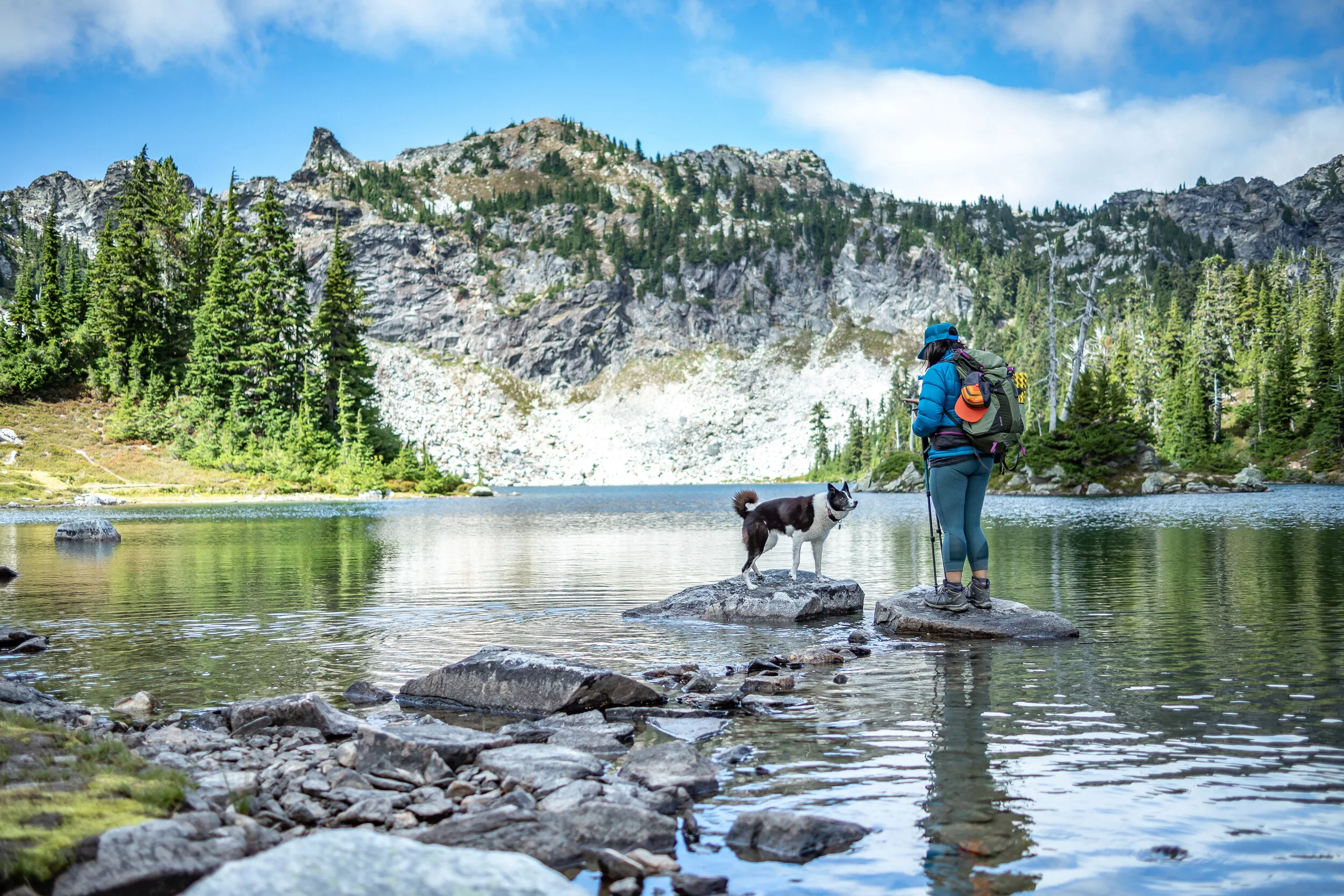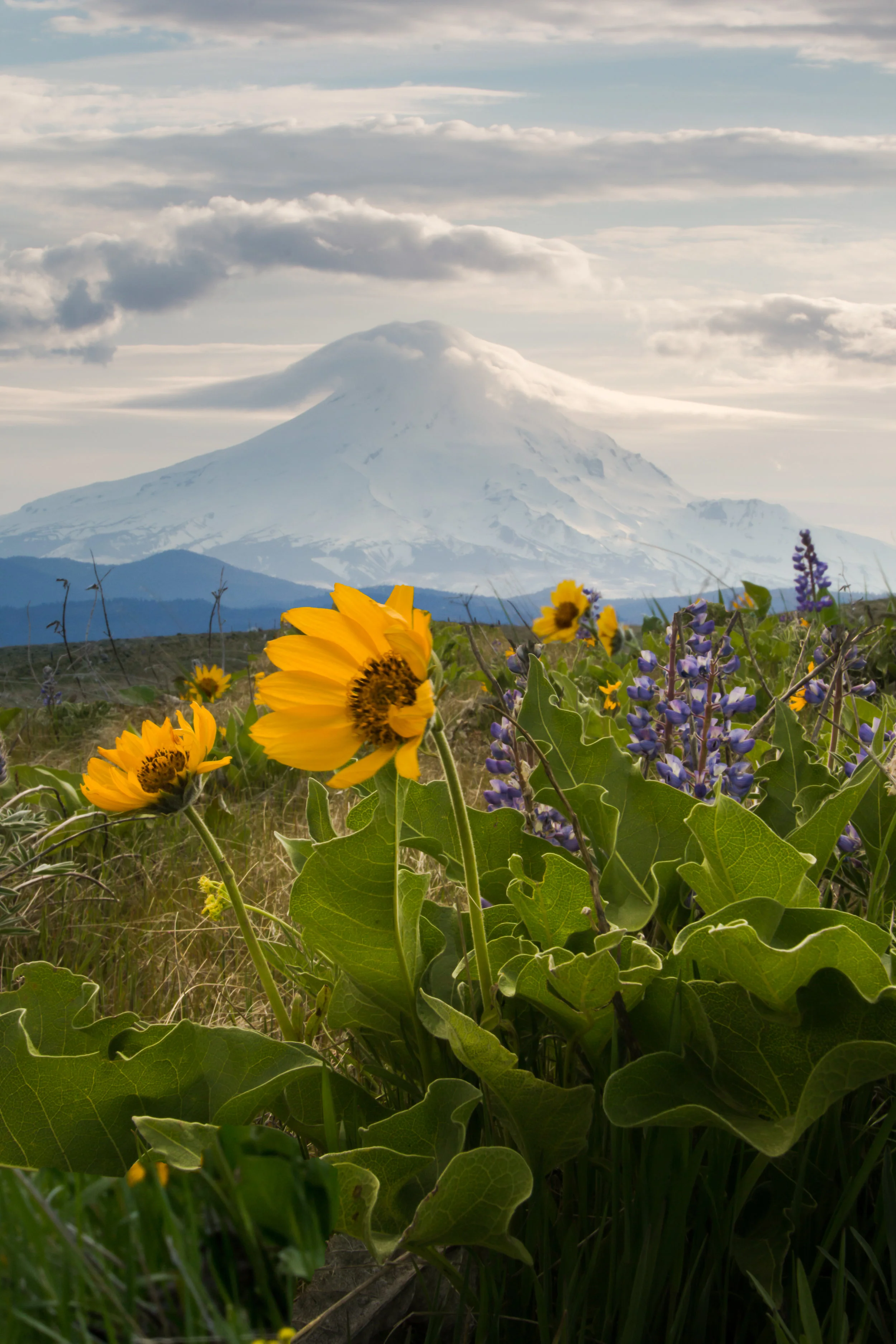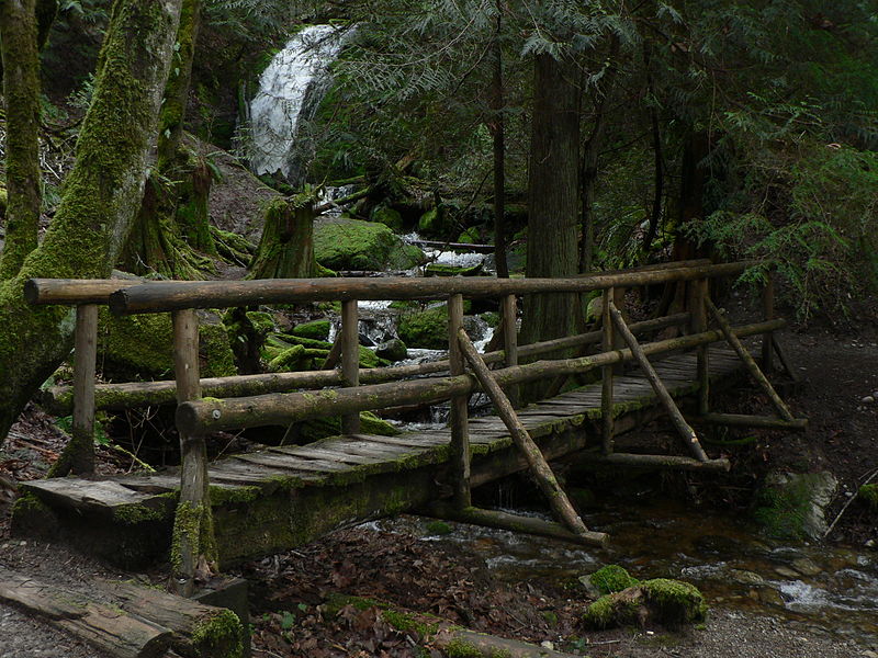
Here are five Nature Conservancy preserves in Washington that you can visit anytime to immerse yourself in the beauty of nature, while learning about The Nature Conservancy’s conservation efforts.

Earth Day was born out of a movement to improve the lives of people and nature, inspiring sweeping legislative action and investments. Today, federal infrastructure funding and WA Climate Commitment Act are a continuation of this movement, investments making a tangible impact locally. As an example, Washington’s historic funding of the Floodplains by Design program is contributing to nature-based floodplain management across the state to reduce flood risk, protect communities and protect salmon habitat. These state and federal dollars are just the start of local climate action that will improve the daily lives and the future of all Washingtonians.
Meet DeAnne Hamilton: Learn how the general manager of Tacoma’s KBTC Public Television and TNC in Washington trustee, uses the power of storytelling to engage people in conservation and create a better future for the next generation.
Nestled in the cliffs in Moses Coulee is an import desert water sources that every springs attracts thousands of Pacific Tree frogs. I came to Whisper Lake for a night concert. It was anything but quiet. The chorus of frogs was soothing, calming—the quintessential sound of spring.
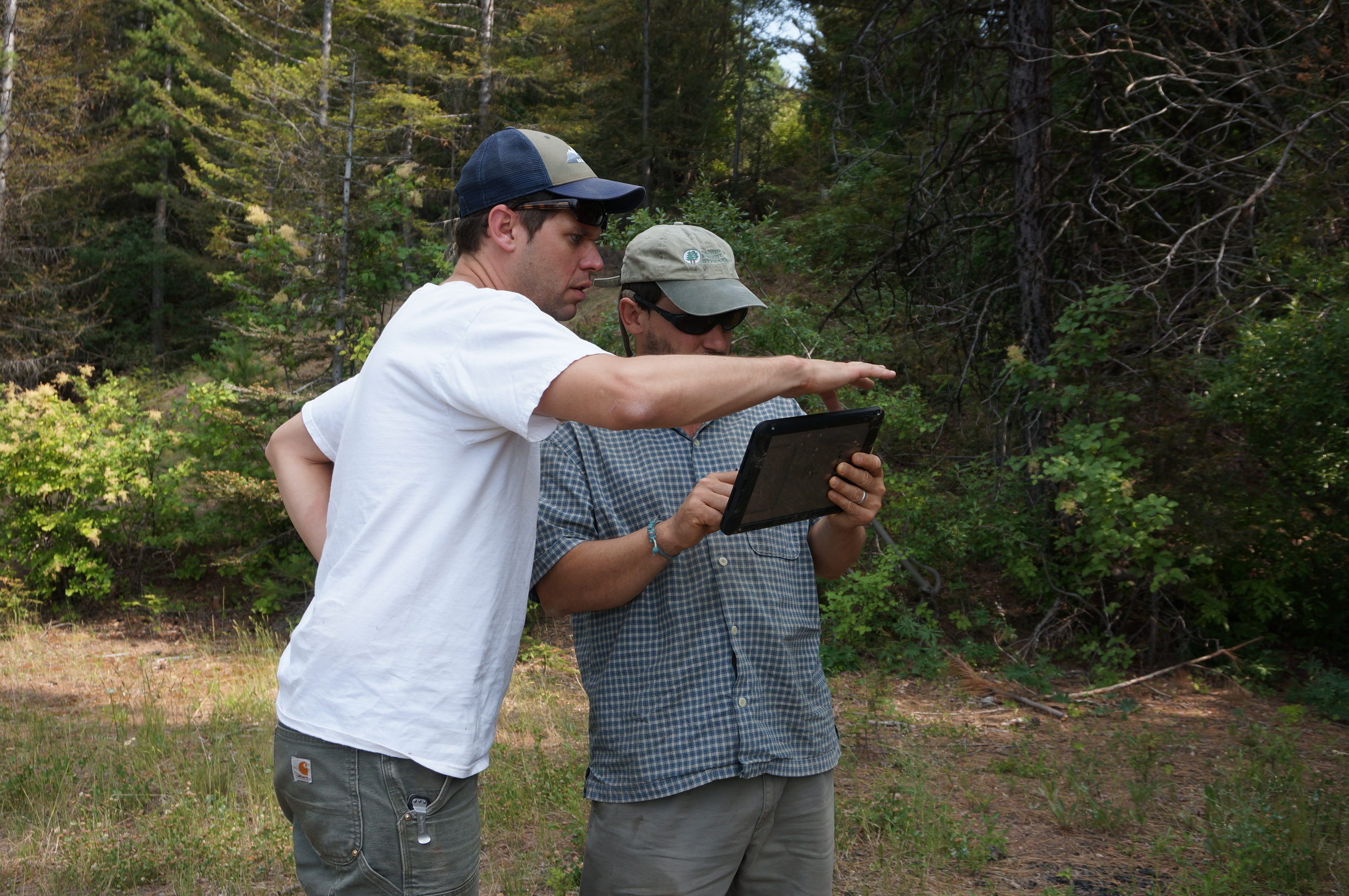
The Cle Elum Wildlife Project is improving our understanding of how wildlife use and move through protected forest landscapes, providing us with an opportunity to test how forest management practices impact wildlife and building an evidence base for permanent protection.

Written and Photographed by Joshua Stern, Northwest Photographer
Every autumn there is an amazing transformation that takes place in the North Cascades—the turning of the larches. These beautiful deciduous conifers abandon their summer green for the warm glow of fall. This natural phenomenon is best showcased amongst the granite peaks and alpine lakes of The Enchantments. To protect this fragile environment wilderness permits, which are limited and difficult to obtain, are required for overnight trips. Unfortunately, I was unable to secure a permit during peak season and knew my only option was a one-day thru hike.
I have always been reticent about thru hiking this route knowing the 18-mile grind would keep me out of the core of the Enchantments during the golden hour. Watching the weather I realized there would be a single bluebird day immediately following a snowstorm. Despite my reservations, the thought of golden larches, alpine lakes, and granite peaks dusted in snow was too powerful to be ignored.
All I can say is the Enchantments blew me away. For the majority of the hike I was in complete awe and left at a loss for words. Every turn in the trail brought a new magical paradise. Nothing exemplified this like the view from Leprechaun Lake: a perfect reflection of golden larches and a snowy McClellan Peak painted on the lake’s still surface. To capture this image, I had to balance, crouching precariously, on the slippery rocks at the edge of lake. Even today, I am left with a perfect memory of that moment, framed in my mind.
I spend much of my time in the mountains and when I am not out in the wilderness I am home thinking about where to explore next. I keep heading back into the mountains for the adventure and challenge each new experience brings. I love our public lands and cherish the environment, as they are what fuel me. However, now more than ever, I fear for their preservation. It's up to us to fight for these special places.
Joshua Stern is a New York transplant who fell in love with the wild landscapes of the Pacific Northwest. He spends his time in the mountains climbing alpine rock, skiing backcountry powder, and backpacking while always searching for the perfect image. You can see more of his work and follow his adventures on Instagram @alpinenapping.
Written & Photographed by Barbara Joan
I had the great fortune of growing up outside. Thanks to my dad's love for and appreciation of the mountains, my earliest and fondest childhood memories involve summers spent foraging for native berries and morel mushrooms, camping under the stars in the Umatilla National Forest, and swimming in remote wilderness rivers. I made houses from sword fern fronds, learned to recognize where the dolly varden were hiding, and took naps in the shade of old growth forests.
Last fall, the depression I experienced in my 20s surprised me by reviving itself the same way I've seen beetles return from the dead when they believe danger has passed. I didn't see it coming and wasn't prepared to manage the familiar feelings and uninvited distorted thinking that invaded my world like noxious weeds. I knew I needed to go outside again and so began my quest to find the beauty in my local public lands and, in the process, remember the beauty in me.
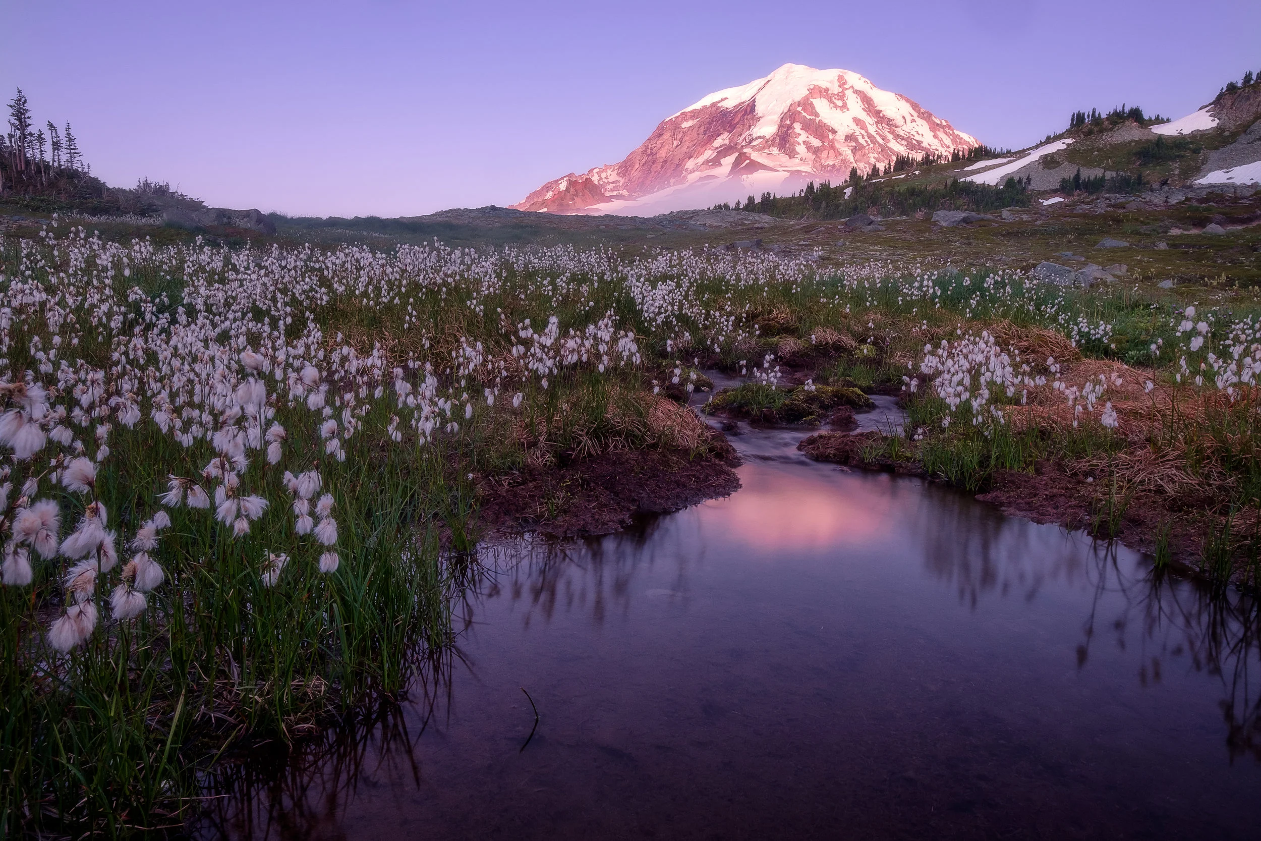
This was a view I found in the first days of August, 2016. Starting in the early afternoon, my husband, my three-year-old and I hiked past Mount Rainier's Frozen Lake to Second Burroughs Mountain. We lingered at the crest for some time in an effort to identify the many wildflower blooms and backcountry birds that fluttered about. We've completed many hikes in and around Mount Rainier, but this was our first time in the alpine tundra and there was so much determination, resilience and hope to take in. What at first glance seemed like a barren wasteland was actually replete with life and I was mesmerized. The parallel to my own internal journey was clear.
I took this photo on our way back down the mountain. Instead of returning as we'd come, we opted for the slightly longer route down the Sunrise Rim Trail. In the early evening glow of the setting sun I heard my son say, "Wow! Mommy! Look at this view!"
I stopped and turned and looked back behind me at this big, glorious, patient mountain. "Son," I said. "Can you believe you own a part of this view?"
He looked at me curiously. "I do?"
"You do. And so does daddy and so do I."
And without a pause, his eyes large and bright and smiling, he said, "We're RICH!"
And we are, aren't we?
Barbara takes and posts pictures of public lands to inspire others to go outside and experience our blessed inheritance and advocate for its protection and preservation. You can see more of her images on her Twitter feed: @publiclandlvr.
Not every outdoors adventure leads to your destination or the perfect photo. Often, lots of persistence and patience is required.
Landscape photography is a pursuit that gets Jake Gosline out into nature and helps to keep him grounded.
This month’s featured photo captures the pivot from summer to fall in the Tieton Canyon.
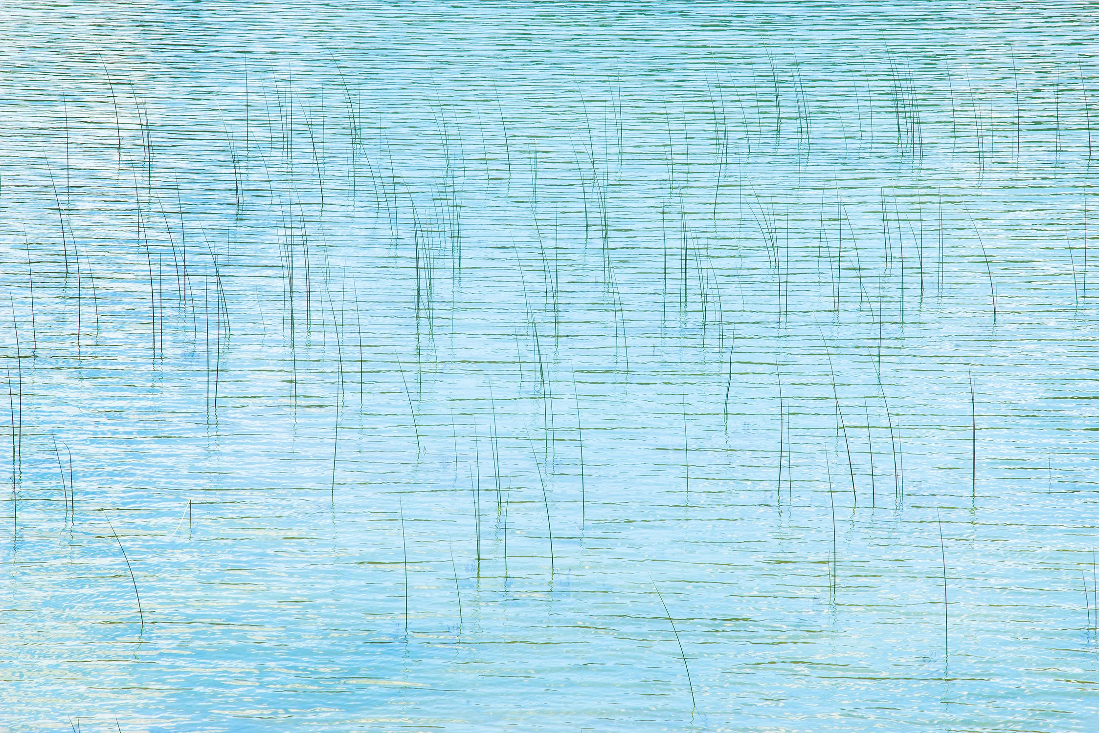
At Park Lake, the waves were no longer moving water — they were but stands of a hair on a bow, moving across the reeds, like the strings of a violin.
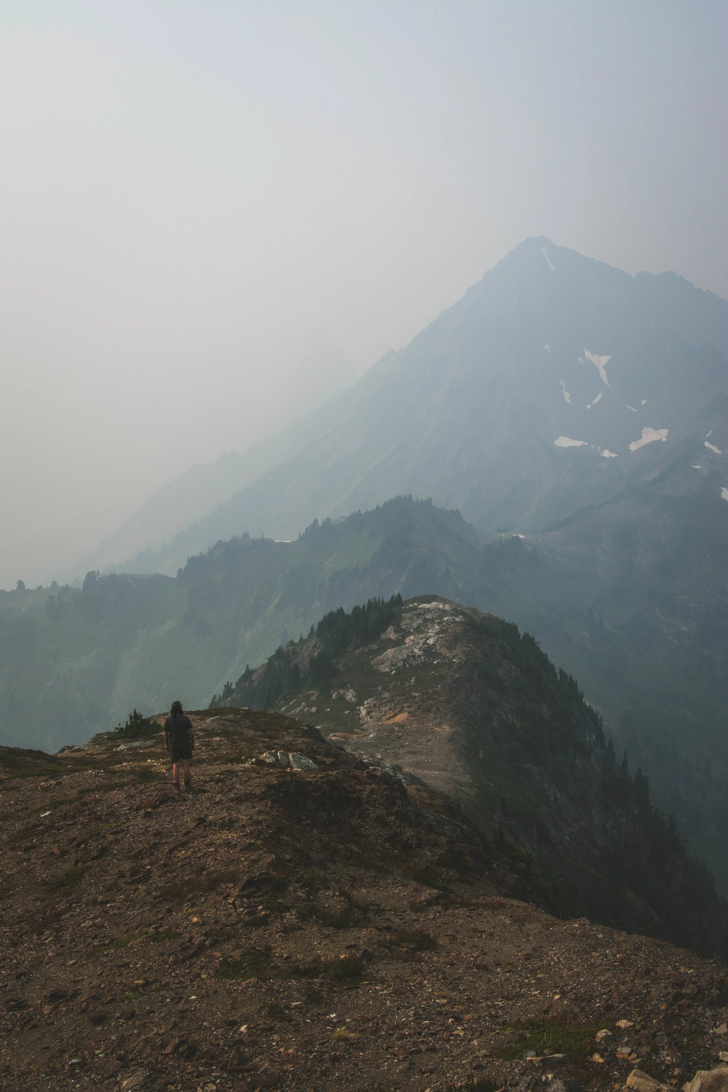
Photographer Cory Zanker revisits a favorite hiking destination, only to find the view obscured by smoke from Western wildfires. He made the most of the situation and found the silver lining.
For Jerad Armijo, photography is soothing, surreal and a fantastic way for him to cope with depression while creating beauty for others to enjoy.
For this photographer of the month, photography is a way to more fully experience life. He doesn’t think of it as hiding behind a lens, removed from life.
We have all been there. It’s easy to feel overwhelmed and not recognize the crucial need for fresh air. A minimal escape can reset your mentality in a crucial way.
Not only does Matt MacPherson find the light of sunsets and sunrises beautiful and exciting, but he likes spending the time in between doing grueling day hikes without having to get his camera gear out.
During backcountry trips, Alex Spaeth is inspired by landscapes both big and small that make him pause and think how fortunate he is to be there to appreciate fleeting, yet lasting, moments.
Photography provides this photographer a means to capture and absorb some of the beautiful places he has been lucky enough to explore and share those experiences with others.
Photography has pushed Riley Rhodes out of his comfort zone and has helped him with social anxiety. What matter is that I’m happy with the art that I am creating.
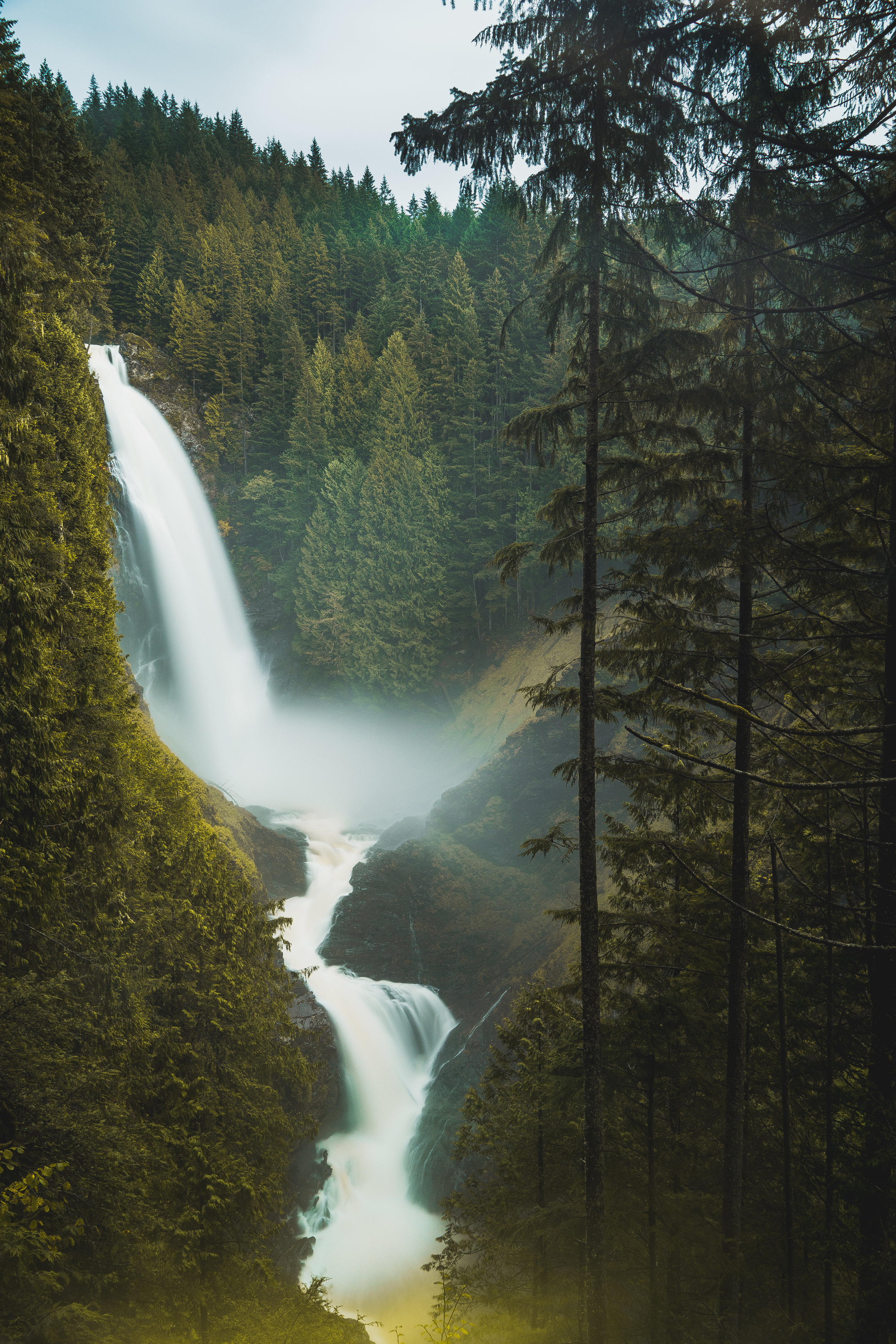
January's photo of the month is like something out of a storybook: A giant waterfall flows off of a cliff and into the sea during an epic sunset.
"Nature speaks what is written upon it, and anyone who reads and acknowledges with an open heart will receive the positivity it speaks," writes our photographer of the month.
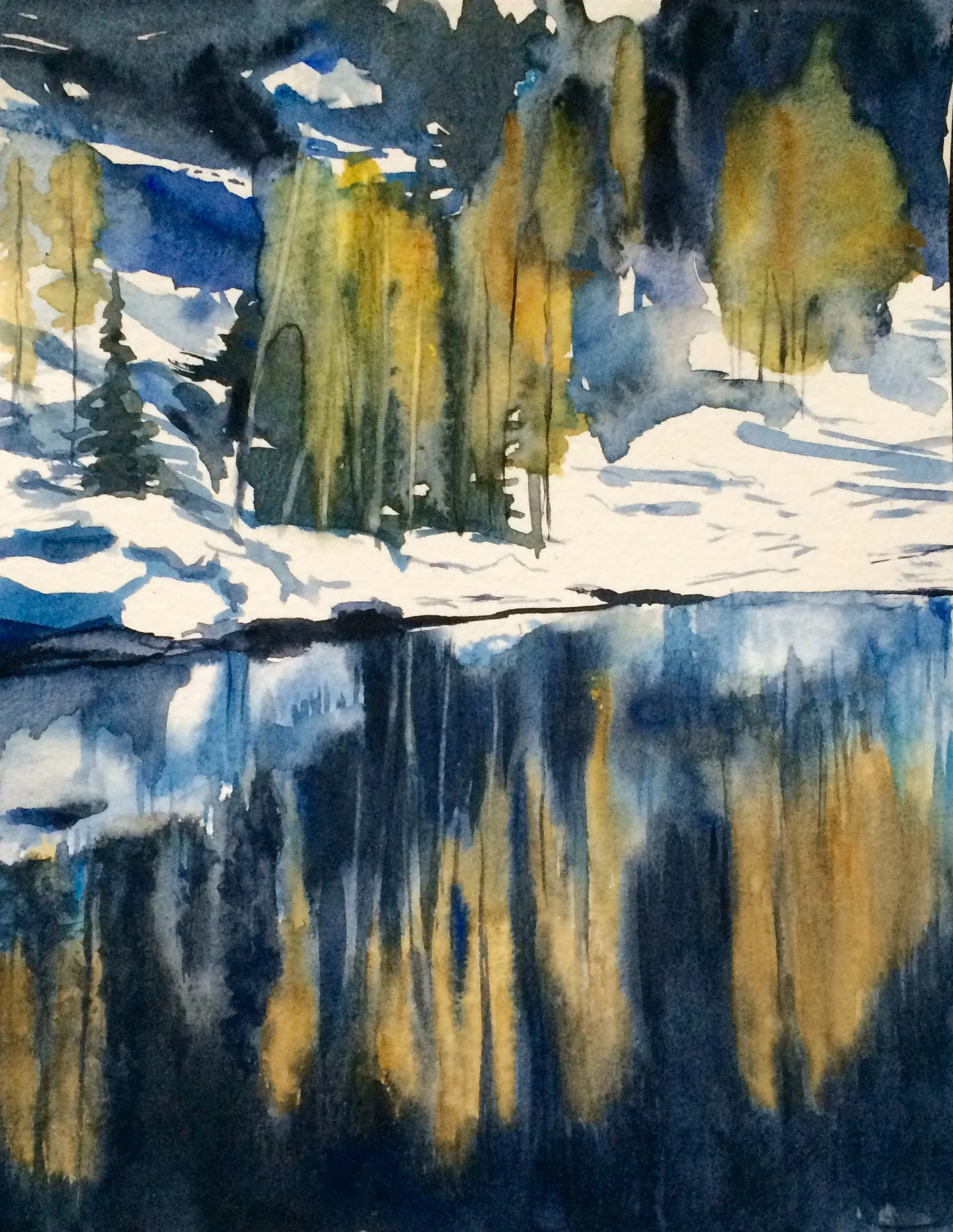
November's "photo" of the month takes some artistic liberties: alpine larch trees reflected in water paint a picturesque watercolor painting.
Our photographer of the month learned that his preconceptions about "the perfect photo" quickly dissipated as the sun rose over Glacier Peak.
Written & Photographed by Katherine Scheulen, Northwest Photographer
This particular photo is meant to evoke calmness, the almost meditative state you feel when gazing at any creek, river or stream. The dusky light, the smoky water, the stillness of an evening where only rushing water roars in your ears.
I really wanted some bluish, low, dusky lighting, so my girlfriend and I waited until evening to wander out to the Old Robe Canyon trail along the Mountain Loop Highway. I wanted to pick somewhere with a good steady flow of water and a trail that wouldn’t be too strenuous to hike back in the dark. Robe is a well-built trail that fit the bill. I set up my Nikon D3300 on a tripod looking out toward the Stillaguamish River, framing it with a few close rocks and a point of rock jutting out into the water. Set the aperture to f/16 with a long exposure since I really wanted the water to look glassy and almost smoky, a good contrast to the jagged roughness of the rock. I had my girlfriend actually press the shutter for me as I scrambled out onto the point. Having one person in the shot to show the scale of the landscape is a great tool I enjoy using. The only trouble was getting me to hold still long enough for the shot!
Landscape photography attracts me in many ways, but especially as a device telling a story about wild places. I grew up in western Washington, the daughter of a mountaineer and an avid recycler backing the 80’s when recycling wasn’t just a given. Conservation and leave no trace ethics are practically in my blood. I cherish and respect our public lands. My hope is always that my photography reflects those feelings, whether it be an intimate look at an individual leaf in its perfectly niche design or a huge panorama to shrink ego and lift the spirit.
Seattle is her home, and she is a native Washingtonian. Katherine has been hiking since a very young age with her father, who was an avid mountaineer in the 80’s and 90’s. Recently, she has started to do a bit of backpacking too and can’t wait for her next adventures. Follow her adventures on instagram: @hiker_katherine
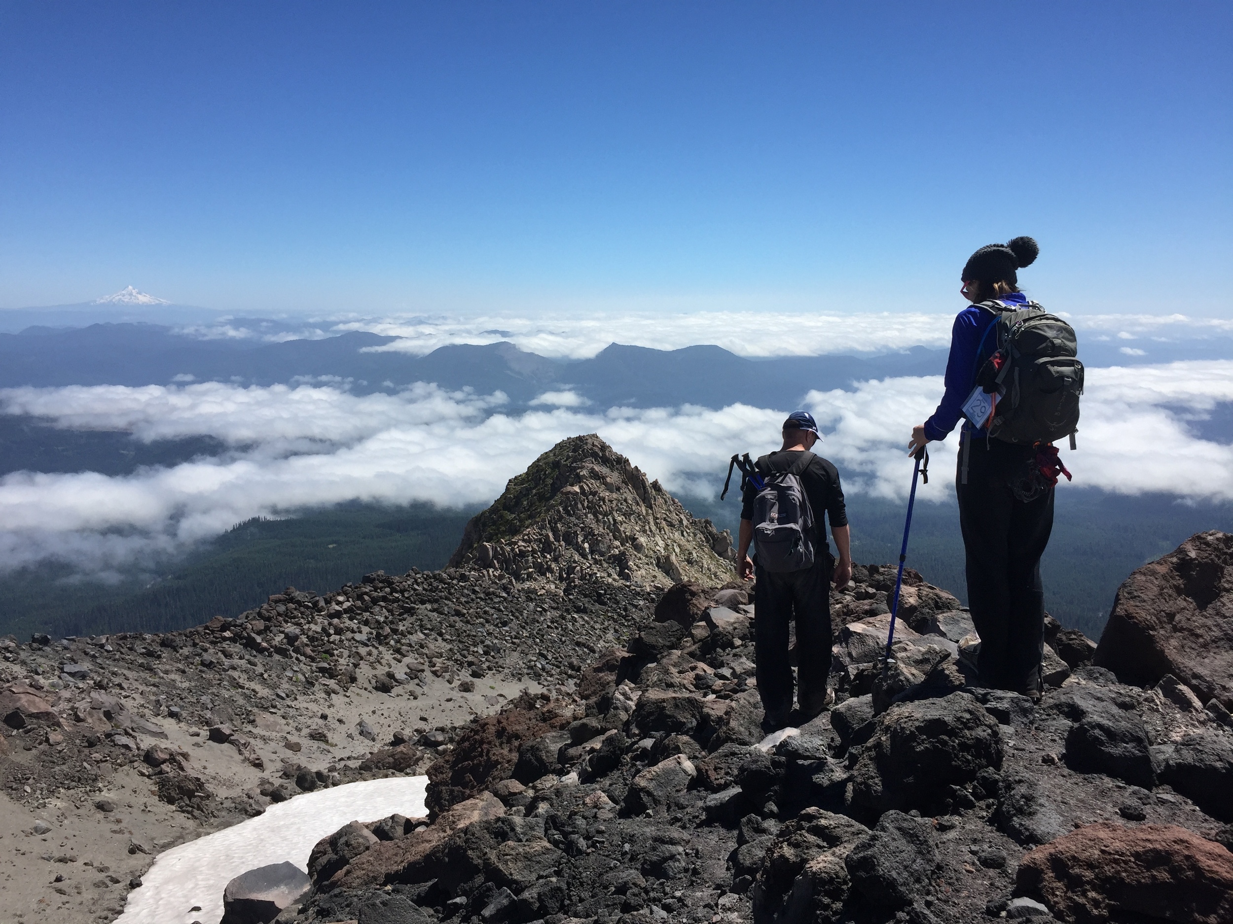
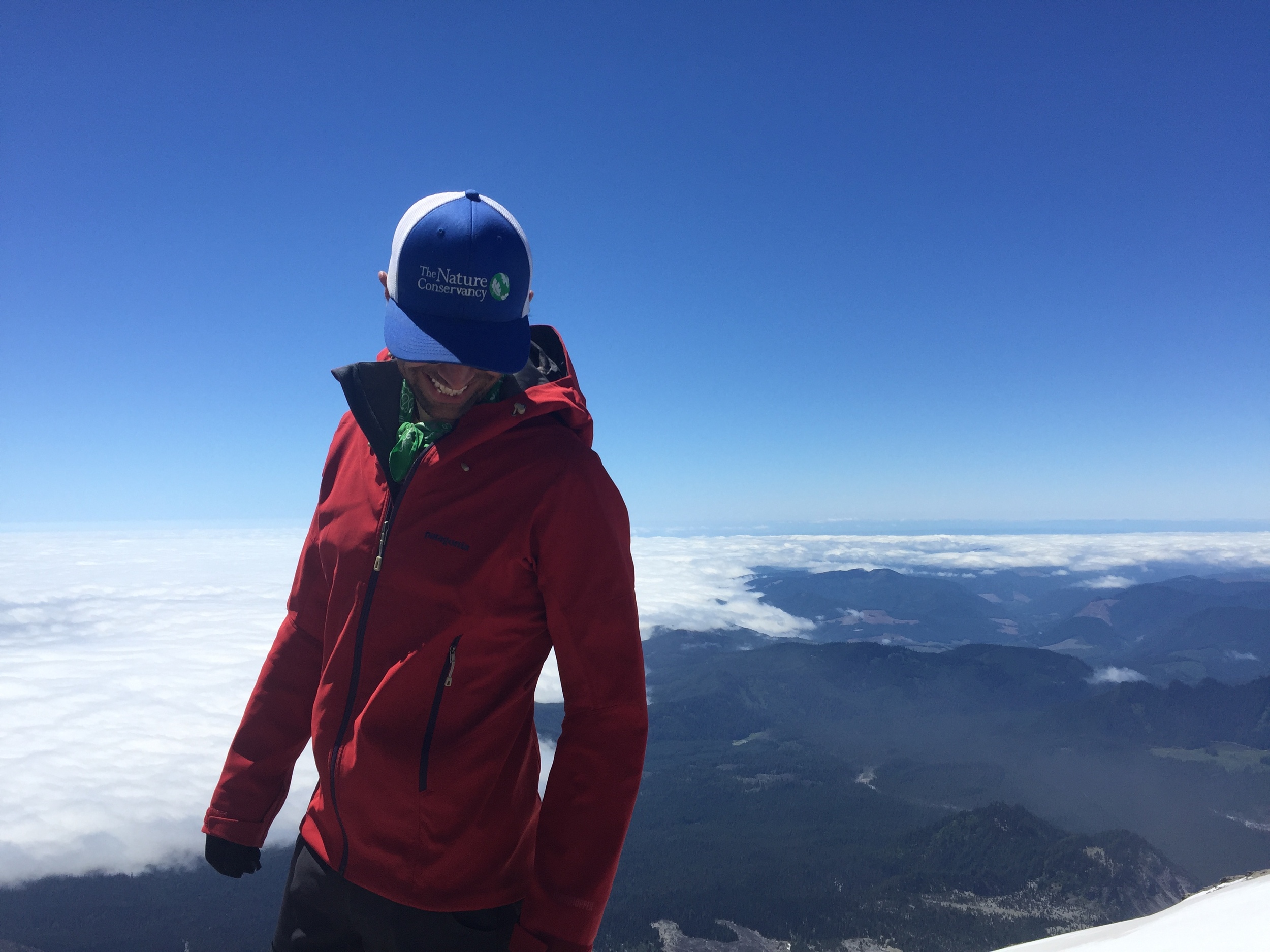
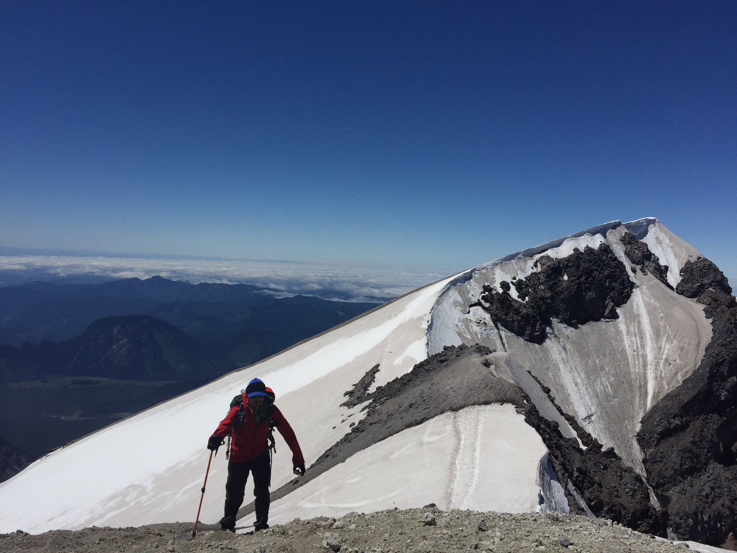
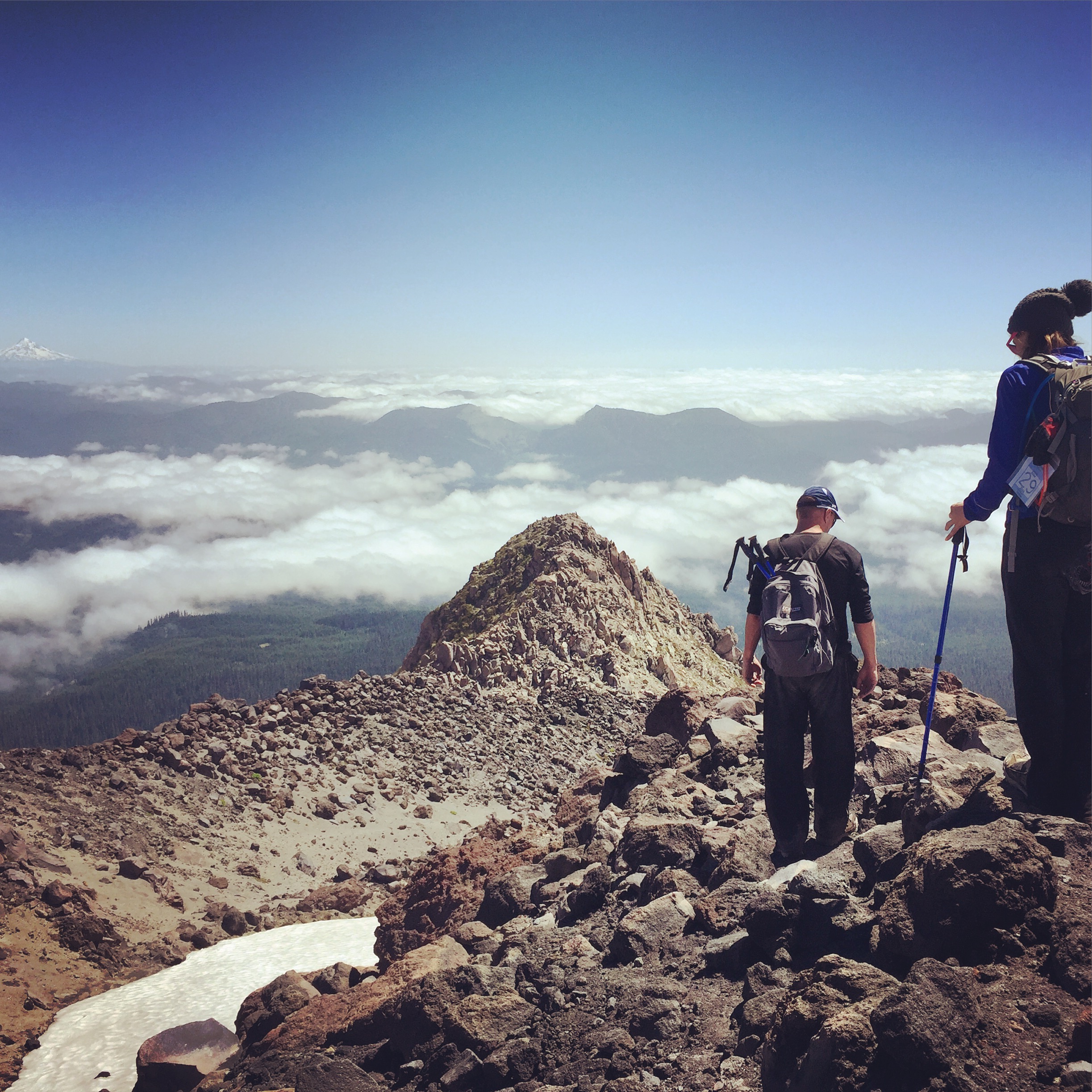
Written & Photographed by Mitch Maxson
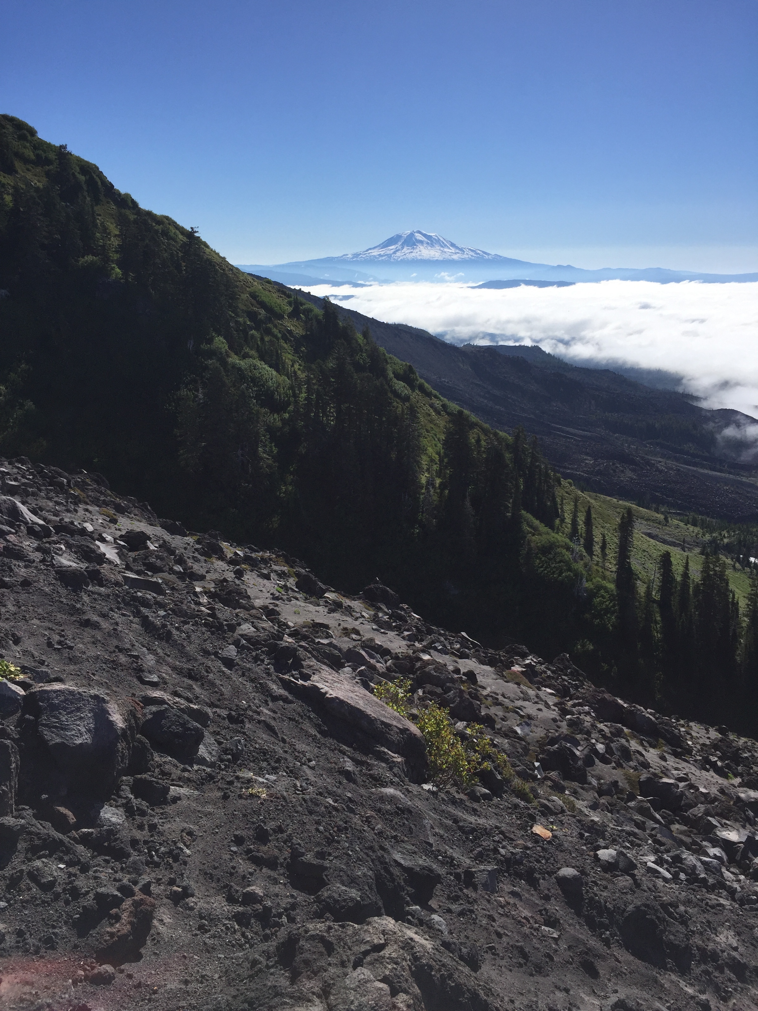
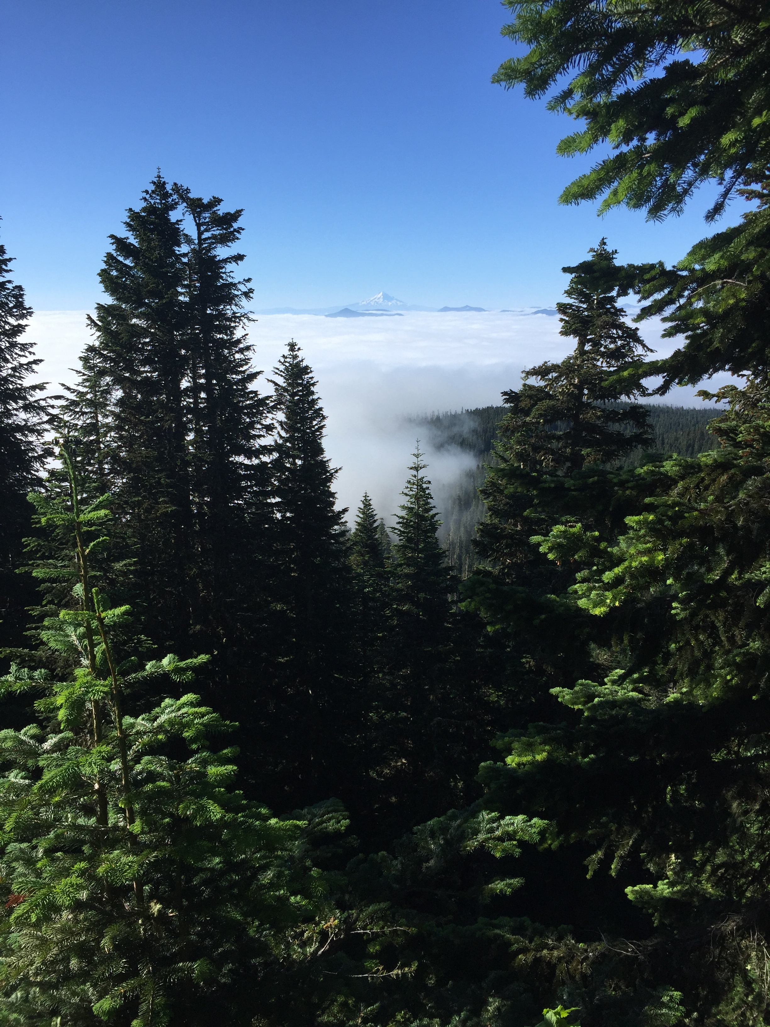
What’s it like at the top of Mount Saint Helens this time of year? Mitch Maxson and his family found out with a late June hike to the summit. Mitch is the Director of Marketing for The Nature Conservancy in Oregon but as these pictures show, he might have a serious case of Washington-envy.
If you want to take in the amazing sights around Mount Saint Helens but are not up for the rigors of a 5000 foot, five mile climb, visit the north side of the mountain where you can drive to various visitor centers and experience the power of this volcano.
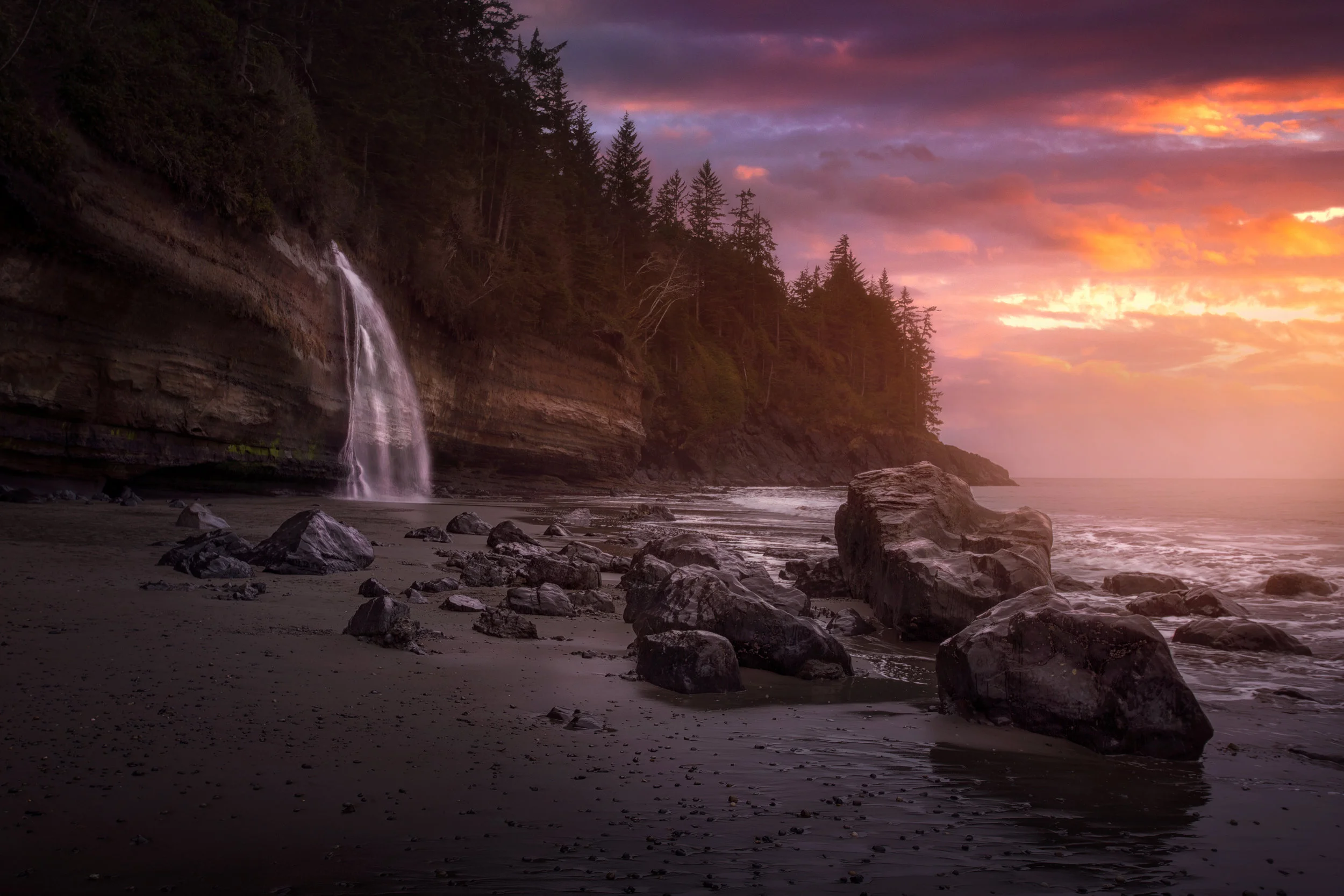
Written & Photographed by Kamini Fonseca, BSc.
Loowit Falls chunders downward with thousands of gallons of glacial melt per hour at the foot of the blast zone on Mount St. Helens.
Starting early in the day, I begin a 27 mile round trip Adventure into the blast zone with a sunset return in mind. The wildflowers are plethorus! Purple Lupine, Yellow False Daisies, Yellow and Black Arnica, and Giant Red Paint Brush all add to the surreal environment.
I find it very powerful and confirming to return to Mount Saint Helens after 26 years to see the incredible regrowth as I begin a new, myself, after a massive Traumatic Brain Injury.
My camera provides me with an integral aspect of healing as it offers an intense mental detail when my physical body requires rest. I'm classically trained as an Exercise Scientist and Wilderness Responder with FEMA credentials, so I'm well-versed at community health and how nature can support healthy minds and bodies.
I lead lots of educational adventures in and outside of Seattle when I'm not making house calls during the week. I specialize in High Performance Training, Functional Neurology and Chronic Pain Management with sports medicine and Natural Science.
My current Community Wellness goal for my photos is to implement them as tools for reducing stress in healthcare settings patient waiting rooms and hospitals.
E-mail her: Kamini@alpineactivities.org or follow her on instagram: @yidography
Written and Photographed by Jason Neuerburg, Northwest Photographer
Curiosity fuels a lot of my adventures. I love driving forest service roads just so I know what's at the end of them. Same goes for hiking trails or a campground space. There's so much to discover in the Northwest and last year, I made over 40 trips to go find what's out there.
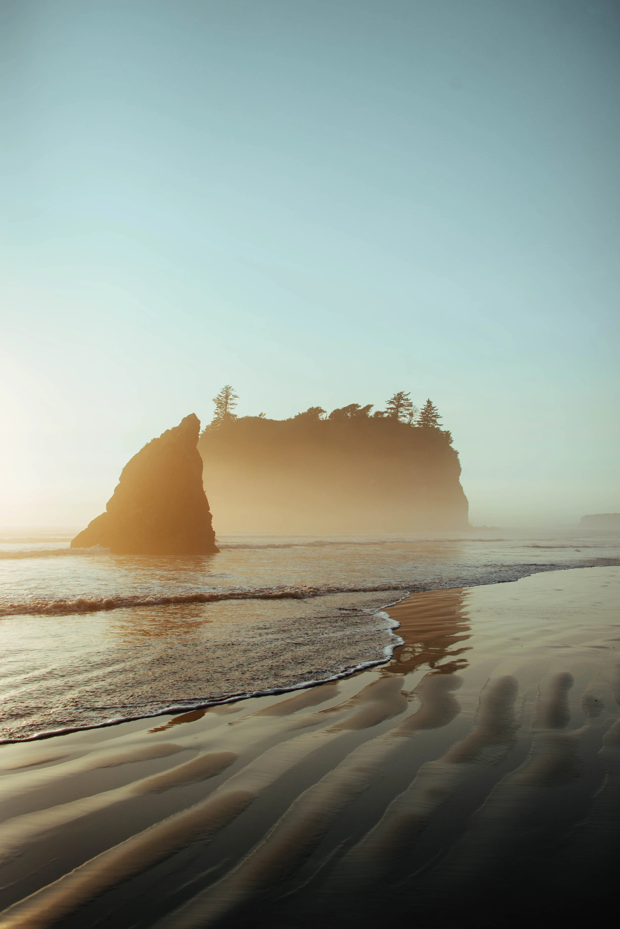
It was February of 2015 and if you remember – there wasn't any snow. It wasn't difficult to convince my friend Kit to join me for a few nights of backpacking. The forecast was set for mid-70's near the coast. We took an early ferry to the peninsula and made our way to Port Angeles to pick up our bear bin and camping permit. Then off to Rialto Beach to hike up the coast to Hole-in-the-Wall Camp. We spent the weekend in front of these two huge sea stacks, which were great subjects to photograph – both during daytime and nighttime.
Since I love to shoot night photography, I always try to look for a campsite with open sky or a subject to light up or silhouette like the sea stacks. This shot combined light from the late evening sky, our campfire, and my headlamp laying inside the tent. When you don't have the powerful sun to contend with, it's much easier controlling the lighting. You can use headlamps, flashlights, glow sticks or even your phone to add light to a scene.
The coast is a wild place to explore and experience its powerful vastness. I plan on more excursions to the coast this year and anticipate capturing a lot more photographs at night around campfires with friends.
Jason grew up in the Driftless Region of Southwest Wisconsin. He's a freelance photographer in Seattle and enjoy coffee, hiking, camping, and going to see live music. Visit his website for more nature and music-centric photography and join him on his adventures here: www.driftlessphotography.com. Follow Jason on Instagram: @driftless_photographer
Not every outdoors adventure leads to your destination or the perfect photo. Often, lots of persistence and patience is required.
Landscape photography is a pursuit that gets Jake Gosline out into nature and helps to keep him grounded.
This month’s featured photo captures the pivot from summer to fall in the Tieton Canyon.
At Park Lake, the waves were no longer moving water — they were but stands of a hair on a bow, moving across the reeds, like the strings of a violin.
Photographer Cory Zanker revisits a favorite hiking destination, only to find the view obscured by smoke from Western wildfires. He made the most of the situation and found the silver lining.
For Jerad Armijo, photography is soothing, surreal and a fantastic way for him to cope with depression while creating beauty for others to enjoy.
For this photographer of the month, photography is a way to more fully experience life. He doesn’t think of it as hiding behind a lens, removed from life.
We have all been there. It’s easy to feel overwhelmed and not recognize the crucial need for fresh air. A minimal escape can reset your mentality in a crucial way.
Not only does Matt MacPherson find the light of sunsets and sunrises beautiful and exciting, but he likes spending the time in between doing grueling day hikes without having to get his camera gear out.
During backcountry trips, Alex Spaeth is inspired by landscapes both big and small that make him pause and think how fortunate he is to be there to appreciate fleeting, yet lasting, moments.
Photography provides this photographer a means to capture and absorb some of the beautiful places he has been lucky enough to explore and share those experiences with others.
Photography has pushed Riley Rhodes out of his comfort zone and has helped him with social anxiety. What matter is that I’m happy with the art that I am creating.
January's photo of the month is like something out of a storybook: A giant waterfall flows off of a cliff and into the sea during an epic sunset.
"Nature speaks what is written upon it, and anyone who reads and acknowledges with an open heart will receive the positivity it speaks," writes our photographer of the month.
November's "photo" of the month takes some artistic liberties: alpine larch trees reflected in water paint a picturesque watercolor painting.
Our photographer of the month learned that his preconceptions about "the perfect photo" quickly dissipated as the sun rose over Glacier Peak.
Written and Photographed by Carrie Krueger, Director of Marketing, The Nature Conservancy in Washington
We want to know: Where do you see Nature Nearby? Share your stories and images below for the chance to be featured on a future blog post!
Our state- and our world – are becoming increasingly urban. For some of us, that means that what was once a rural suburb is now a bustling city filled with homes and high rises. Yet as we grow, it’s vital we keep a strong connection to nature including wildlife corridors, water retention areas and places we can go for peace and solace.
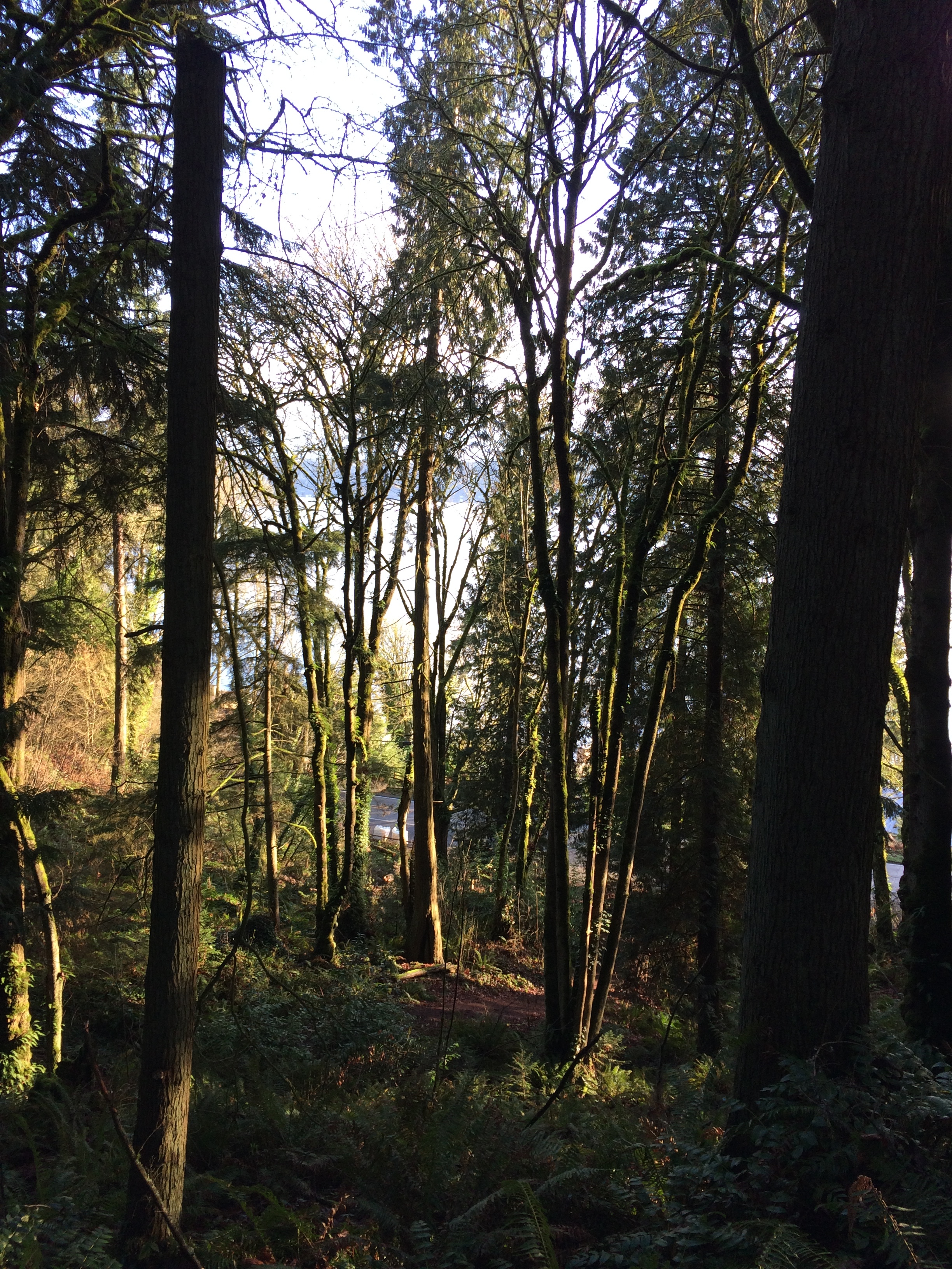
Bellevue has gone from sleepy bedroom community to hub of commerce and industry. But its string of pearls is a connected series of parks allowing us to travel from Lake Sammamish to Lake Washington through forests, wetlands, farms and gardens.
Most recently, I began this trek at Weowna Park on the shores of Lake Sammamish. In the crisp morning air, we climbed through lush, mossy forests, across streams, occasionally pausing to look back at the lake below. We emerged into a residential area and wandered through lovely neighborhoods, past the Lake Hills Park.
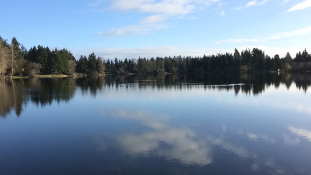
Phantom Lake and the surrounding wetlands were teeming with birds, and as we made our way through the Lake Hills greenbelt, many walkers carried binoculars. The meandering greenbelt features towering trees, wetlands and even agriculture in the form of blueberry farms where signs of a tasty harvest next summer are just beginning. At the northern end of the greenbelt is beautiful Larson Lake – so peaceful though thoroughfare traffic, shopping and other signs of urban life are close by.
Following the trail behind and around Sammamish High School, we were again reminded that we are in the middle of a burgeoning city where the already large high school is being expanded to accommodate growth. But just beyond, we were plunged back into nature, joining the powerline trail and then the forest behind Kelsey Creek Farm. In the creek, salmon still spawn and the surrounding wetlands hold and filter water. In the middle, farm animals are a draw for kids – and their parents.
Just three blocks of neighborhood walking took us to the rich forest east of Wilberton Park. Ballfields and a playground on the other side connected us to the Bellevue Botanical Gardens. Here there is much to see in the form of immaculate, groomed gardens but also a wild canyon experience complete with a suspension bridge.
From the serenity of the gardens, we experienced the most urban and perhaps least enjoyable part of the trek – a brief walk directly parallel to the much-used 405 freeway. It’s hard to ignore growth and demands on nature when walking next to a jam-packed freeway. Fortunately we were quickly under the 405 and into the spectacular Mercer Slough. It’s remarkable that such an important and natural place exists in the shadow of downtown high-rises. Heron, turtles and other wildlife are common sights and this time of year, hints of spring popping up everywhere.
From the slough, we shared the trail with bicyclists as we made our way to the shore of Lake Washington at Enatai park. The park is a perfect place for considering the interface between nature and development because it is set literally underneath the I-90 freeway. Yet looking out on to the lake, nature abounds as does wildlife and recreation.
Our trek through Bellevue demonstrates many of the benefits of creating a strong tie to nature in the midst of intense growth. Parks, greenbelts and even small pockets of plants foster wildlife, cool the air in the summer, clean urban storm water runoff and give us a place to retreat and reenergize.
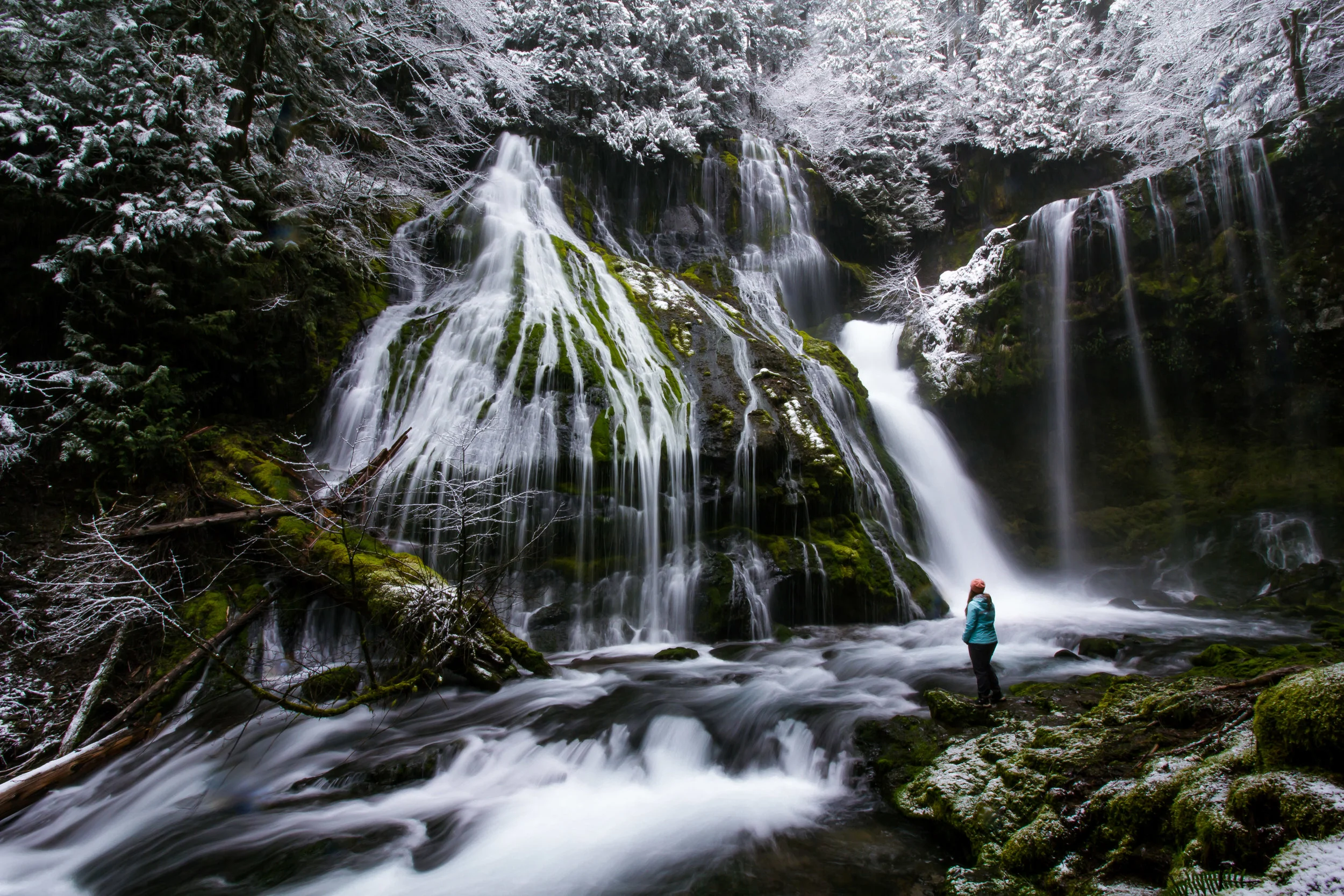
Written and Photographed by Chris Liedle, Northwest Photographer
What's the familiar saying? Sometimes the best adventures are the ones you didn't plan for. That's what you could say happened here. My friend Matt and I packed our hiking gear and grabbed our cameras, and then took off for the Columbia River Gorge. Where should we go, what should we see? Oneonta Gorge, yes. Gorton Creek Falls, maybe. What about Spirit Falls? We checked our GPS. It added nearly an hour of driving time. We quickly began passing freeway exit after freeway exit, then missed our turn off to Oneonta. I guess, Spirit Falls it is!
We left Oregon and crossed into Washington, winding our way up to the trailhead. And by trailhead, I mean, goat trail. It's a steep, half-mile scramble on loose rock to the falls, but the trail is used just enough. Swollen from recent rains, Spirit Falls thundered through the canyon. We were there for only a few minutes, when I saw a kayaker in all red, scouting the drop. When I saw him reach for a camera, I knew someone was coming. No time to change lenses. The kayaker plunged, disappeared, then dodged a fallen tree. We cheered him on as he paddled below.
I shot a series of photos, hoping at least one picture turned out. I was stunned. The image was beautiful. The true colors of the Little White Salmon River came to life in the sunlight. Thick fir trees towered above. The paddling kayaker, frozen in time. Luck, probably, but I'm always amazed at what nature has in store. There's an enchanting view at every turn, whether it's a strenuous hike downhill to a waterfall or up the side of a mountain. The wilderness is a humbling place, a place where you can leave worry behind and enjoy what's in front of you. The wilderness, to me, is grounding. It's inspiring. It's home.
I learned the kayaker is Aniol Serrasolses, a professional whitewater kayaker from Spain. Welcome to the Pacific Northwest!
Originally from San Diego, Chris moved to the Pacific Northwest several years ago and is a television reporter in Portland. You'll find him in the chilly water surfing off the Oregon Coast or on the trail backpacking in the Cascades. Follow him on Instagram @ChrisLiedle or visit his website.
Not every outdoors adventure leads to your destination or the perfect photo. Often, lots of persistence and patience is required.
Landscape photography is a pursuit that gets Jake Gosline out into nature and helps to keep him grounded.
This month’s featured photo captures the pivot from summer to fall in the Tieton Canyon.
At Park Lake, the waves were no longer moving water — they were but stands of a hair on a bow, moving across the reeds, like the strings of a violin.
Photographer Cory Zanker revisits a favorite hiking destination, only to find the view obscured by smoke from Western wildfires. He made the most of the situation and found the silver lining.
For Jerad Armijo, photography is soothing, surreal and a fantastic way for him to cope with depression while creating beauty for others to enjoy.
For this photographer of the month, photography is a way to more fully experience life. He doesn’t think of it as hiding behind a lens, removed from life.
We have all been there. It’s easy to feel overwhelmed and not recognize the crucial need for fresh air. A minimal escape can reset your mentality in a crucial way.
Not only does Matt MacPherson find the light of sunsets and sunrises beautiful and exciting, but he likes spending the time in between doing grueling day hikes without having to get his camera gear out.
During backcountry trips, Alex Spaeth is inspired by landscapes both big and small that make him pause and think how fortunate he is to be there to appreciate fleeting, yet lasting, moments.
Written and Photographed by Riley Beck, Northwest Photographer
My friends and I decided to drive down to Tolmie Peak Fire Lookout at Mount Rainer National Park for a sunrise. We didn't sleep (being that the drive was a little over a three hour drive from home). We got coffee from the 24 hour coffee stand and left around one in the morning.
After hours of driving, followed by 17 miles of potholes and washboard, we arrived at the trailhead and took off with headlamps excited for what was ahead. It was my first time that close to Mount Rainer and it was stunning. You reach Eunice Lake a couple miles in and see Rainer for the first time in all of its glory and a fire lookout perched high above the lake.
Some moderate switchbacks lead you above Eunice Lake until you reach the fire lookout. If there is possibly a perfect sunrise spot in Washington this is it. An unobstructed view of Rainer lit up by the golden sun with Eunice Lake below is the perfect setting. It was a very long night and morning, but well worth the hours of driving and lack of sleep. The trip and view are one I will not soon forget.
Riley Beck has lived in Washington his whole life. He enjoys hiking and backpacking with his friends and spends every day off possible on the trails. See more of his photos.
Written by Lauren Miheli, Volunteer Coordinator
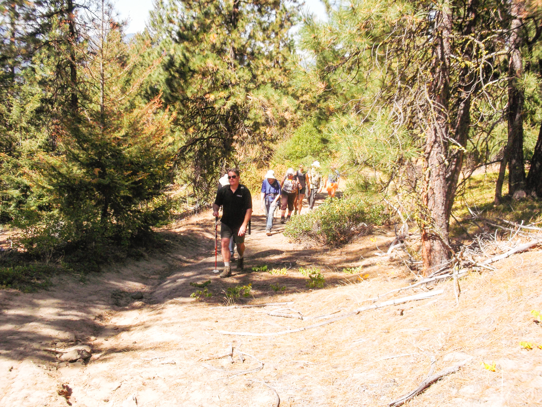
Recently a friend invited me to an event called “Party Bus Hike: Cougar Mountain Grand Traverse.” Now I’ve been invited to many parties and events in my day, but never anything like this! I was intrigued and sent in my RSVP immediately.
If you’re like me and grew up in a lower-income urban community, honestly, outdoor activities can be a little intimidating. Sometimes it feels like you need a lot of expensive gear just to fit in on the trail. Heaven forbid you wear a cotton shirt instead of the most high-tech, synthetic, moisture-wicking garb money can buy. And how are you going to get to a trail head without a 4-wheel drive sports vehicle? My clothes are for urban adventures and I don’t have a car, so even though I work for The Nature Conservancy, I am embarrassed to admit I don’t get out and hike as much as I’d like to. What I do have is a sense of adventure and an ORCA card, which I was excited to learn, would be enough to get me out of the city and to the trailhead!
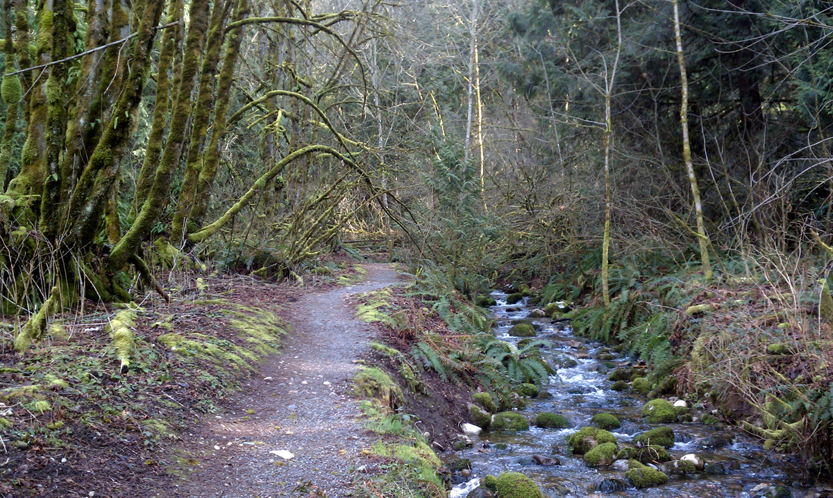
The plan for the day was to meet in the International District, take a bus to Bellevue, hike 11 miles through the Coal Creek and Cougar Mountain trails to arrive in Issaquah and catch a bus from the Issaquah Transit Center back to Seattle. A group of about 10 people met for this mini-expedition. On the bus ride out we got to know each other, and we solidified our new friendships during the hike. The trail was moderate, with babbling brooks, the soothing smell of pine in the air, and a peaceful waterfall lunch stop. Bussing back was a breeze, we all connected with each other and relaxed, and no one had to worry about staying awake at the wheel to get everyone home.
The hike was organized by Adrian Laurenzi, a local Software Engineer who co-founded an app called TOTAGO (developed by Open PlanIt and now public on the Google Play Store), that will help urban outdoor enthusiast’s access great trails using bus systems. I could not be more excited for this idea! Just think of all the people who could benefit from this tool. College students, young families, urban dwellers, the list goes on. Don’t have money for a car, gas, or parking fees? Busses are relatively affordable for everyone. Even if you do have a car, chances are that as someone who loves nature you’ve felt guilty about your carbon footprint and wouldn’t mind reducing your emissions.
Society has a long way to go in making outdoors activities accessible to everyone, which is something we certainly need to do if we’re going to inspire support for protecting our natural resources, but a tool like this is one is definitely a step in the right direction, and I’m looking forward to its launch and using my bus pass to go on more hikes!
More information about the Cougar Mountain Grand Traverse can be found here.
More information about the Totago app project can be found here.


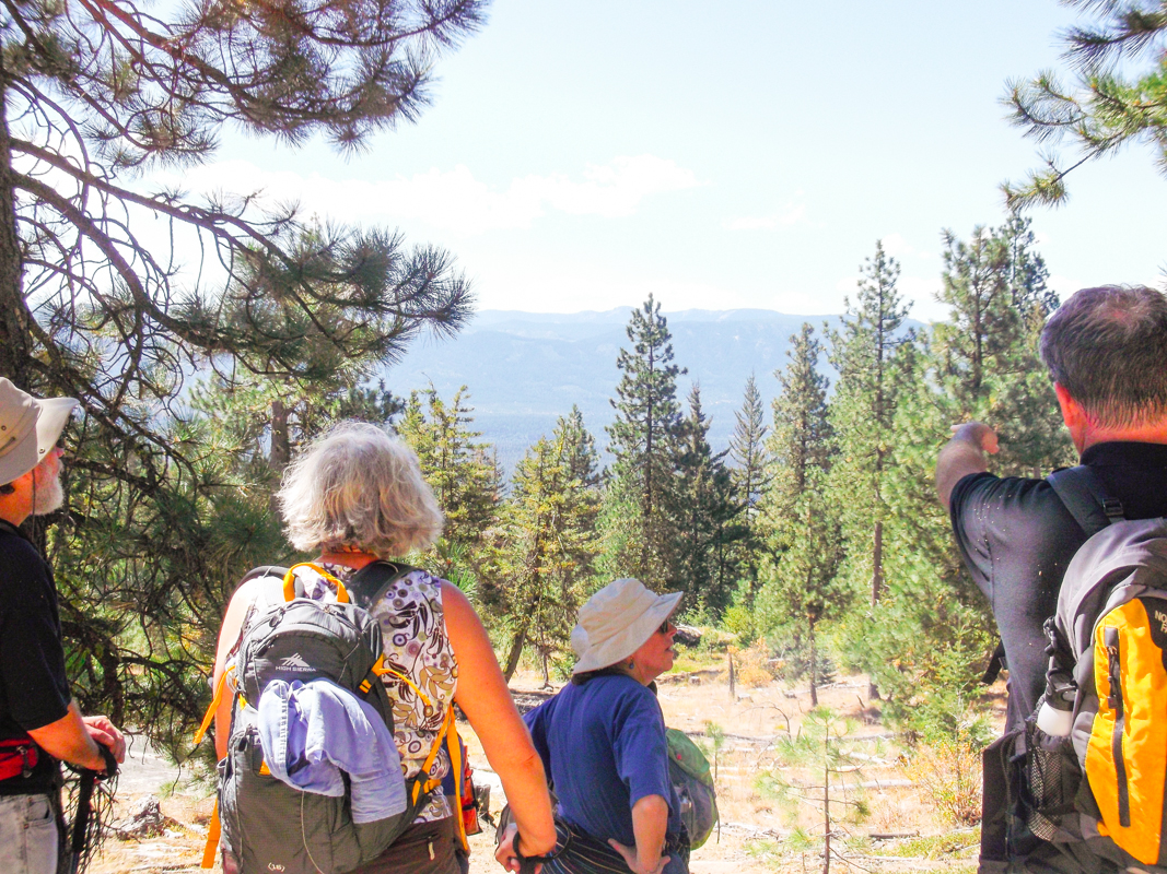
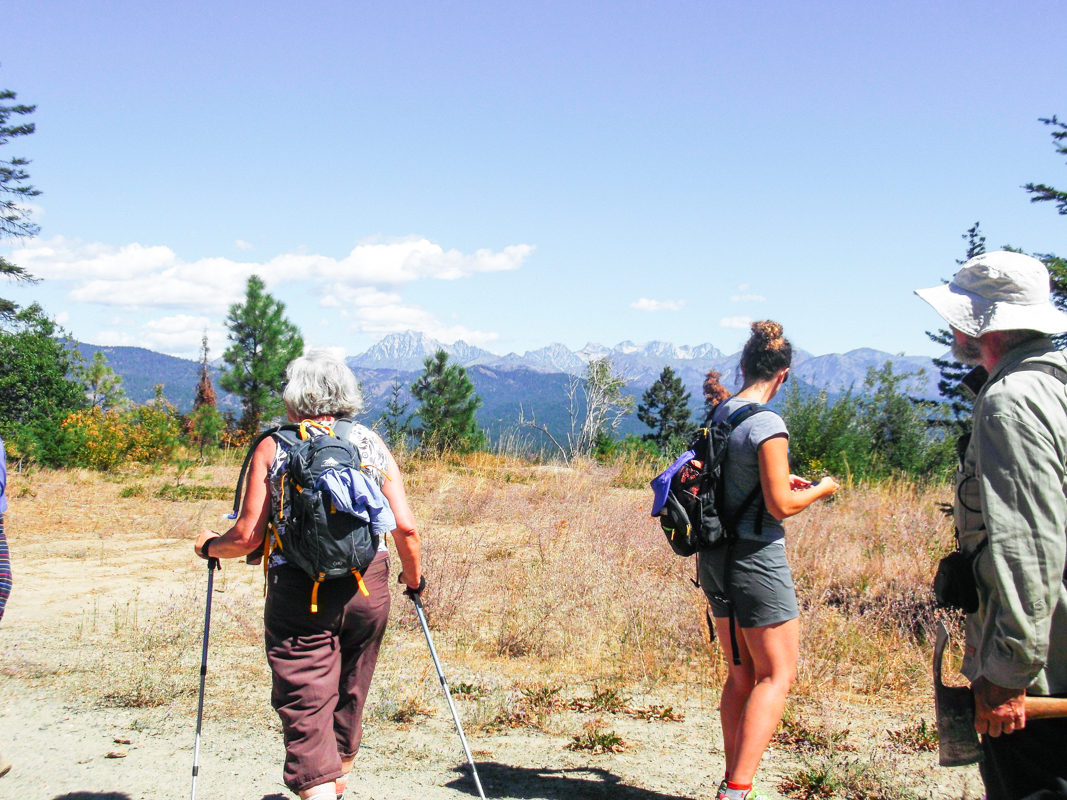
Member hikes in the Central Cascades
Written by Cailin Mackenzie, Marketing Intern
Photography by Nathan Hadley
One of our wonderful members who joined us for a hike last week referred to the Forests for our Future as “our land.” This simple turn of phrase represents what makes The Nature Conservancy able to create significant environmental benefit at impactful scale: dedicated supporters with deep passion about the lands and waters we all protect.
Our forest team has led two hikes with Conservancy members this fall, with another coming up in October. Our members are truly partners in our work to sustain Washington’s natural resources for future generations. On the hike, one member showed our group what a Douglas fir pine cone looks like after as squirrel has enjoyed his lunch. Another taught about her work with the wildlife bridges along the I-90 corridor. I don’t know about you, but after I’ve helped core a Ponderosa pine, counting its rings and starkly seeing different growth rates over its long life, I feel a deeper connection to the systems that nourish me. When I see 1000 species of flora and fauna growing proximate to almost 1800 people, I better understand the challenges and opportunities of living with nature for a symbiotic future.
Hiking with members has been an inspiring opportunity to be invigorated by the commitment of our community to the work we do. This community of resolved support will help stitch together Washington’s landscapes and strengthen nature’s remarkable capability.
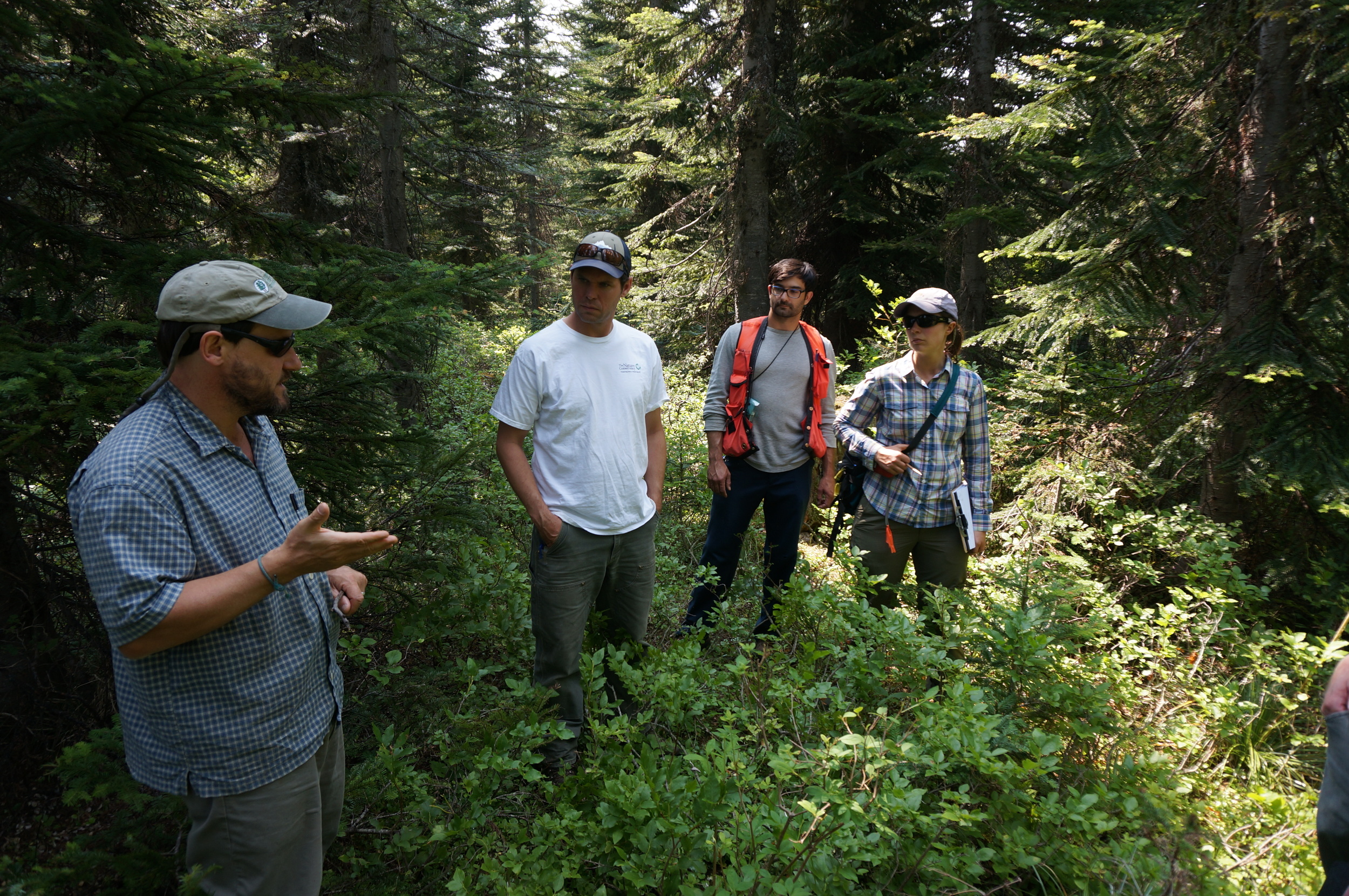
Written and Photographed by Cailin Mackenzie, Marketing Intern
Last week, Conservancy members explored our conserved land in the Central Cascade region with James Schroeder, Director of Forest Conservation & Partnerships, and Brian Mize, Central Cascades Field Forester.
We smelled Ponderosa pine bark, which smells like vanilla, cinnamon, or even coconut for different people. We learned how a native species like spruce budworm can become a pest because of habitat disturbance and climate change. And we observed how reuniting the fractured Cascades checkerboard will benefit wildlife, water, climate, and people for generations.
There are three more opportunities to hike with us on our new acquisition! Let this special place inspire you on Wednesday, September 16th; Saturday, September 19th; or Sunday, October 4th. RSVP to WaEvents@tnc.org - we’d love to share our work with you!

Written and Photographed by Sam Davis, Northwest Photographer
It was Fourth of July weekend, and not wanting to be surrounded by people blowing things up, my wife and I decided to load up the truck and head for the mountains. We had a better idea in mind for celebrating our independence and it consisted of a trip to Sahale Arm.
Our original plan was to snag a permit at the Marblemount Ranger Station and spend the night at the Sahale Glacier Camp, but unfortunately all of the spots had been claimed so we decided to make it a day trip instead.
Having been in the area before that year on El Dorado, I was excited to get a slightly different perspective from Sahale Arm of the surrounding peaks. After making it through the seemingly endless switchbacks, we were finally rewarded with open views of Johannesburg Mountain.
Continuing on the trail, we saw a few deer making their way through the brush and enjoying the beautiful weather and views. As we approached the Sahale Arm we were treated to breathtaking views of some of my favorite North Cascade Peaks including Eldorado, Forbidden, The Triplets and Mixup.
Having reached a great resting spot with 360 degrees of stunning views, we fueled up and soaked in the sunshine. Our plan was to enjoy the weather and take our time to explore. With the sun setting later in the day, we had enough time to take a nap and snap some pictures as we continued upwards towards Sahale Peak.
When we came across this particular meadow, I couldn’t believe that a place like this exists just a few short hours from the busy city. This spot was stunning to me because of its contrast. Here you are walking through a beautiful and soft meadow filled with wildflowers, while in the distance jagged mountain tops carve out the horizon. I dropped everything, grabbed my camera and hit the shutter button. This was definitely one of the most memorable scenes I’ve ever experienced.
We spent the rest of the evening enjoying a warm meal while watching the sky turn majestic colors as the sun began to set. It was hard to leave such a beautiful place and I look forward to returning soon.
Sam Davis grew up in the Pacific Northwest and currently lives in Seattle. He works as an accountant during the week and spends his weekends exploring the Cascades with his wife and dog. See more of his work: http://www.samdavisphotography.com/

Written and Photographed by Carrie Krueger, Director of Marketing
It’s thrilling to be offering the tiniest of tours of our new back yard. 48,000 acres is an awful lot to show off, so for our member hikes this year, we’ll have to settle for just a peek at all our land in the Central Cascades has to offer.
Mapping the route for these member hikes proved tricky. The landscape is inherently rugged and steep. Despite our efforts to weave together the fractured landscape, property ownership is still disparate and a desirable path may cross many boundaries. Some of the land is crisscrossed with trails used by a variety of recreationalists but not necessarily suited for hikers.
I was lucky enough to spend a day with our forest team searching for the perfect hike. It was not just another day at the office! Over the course of several hours, I took in old growth, stunning views, restored landscape and places in need of work. I was most struck by the birds and butterflies. They seemed to be everywhere, even following us as we explored.
The trek also allowed me to talk with our forest team and hear more about the work they are doing to develop a management plan for the land. If you’ve ever done a home remodel, you know that having a plan is critical. Think about creating that vision and the practical details for 48,000 acres! The need for restoration is evident as is the potential for community benefit in the form of jobs and recreation. This land can be a real win for people and for nature.
As we hiked, we mapped every twist and turn using GPS, noting elevation gains and asking ourselves, “Would this be fun for a group hike?” With you in mind, we came up with a route that we think is beautiful, challenging but not too hard, features beautiful views and most important tells the story of why these lands matter and why we need your support to protect and restore them.
Join us on what we hope will be the first of many adventures in your new backyard. We’ll be taking people out on our new route August 8, September 16 and October 4.
You can get details and RSVP at WaEvents@TNC.org.
Hope to see you out there!
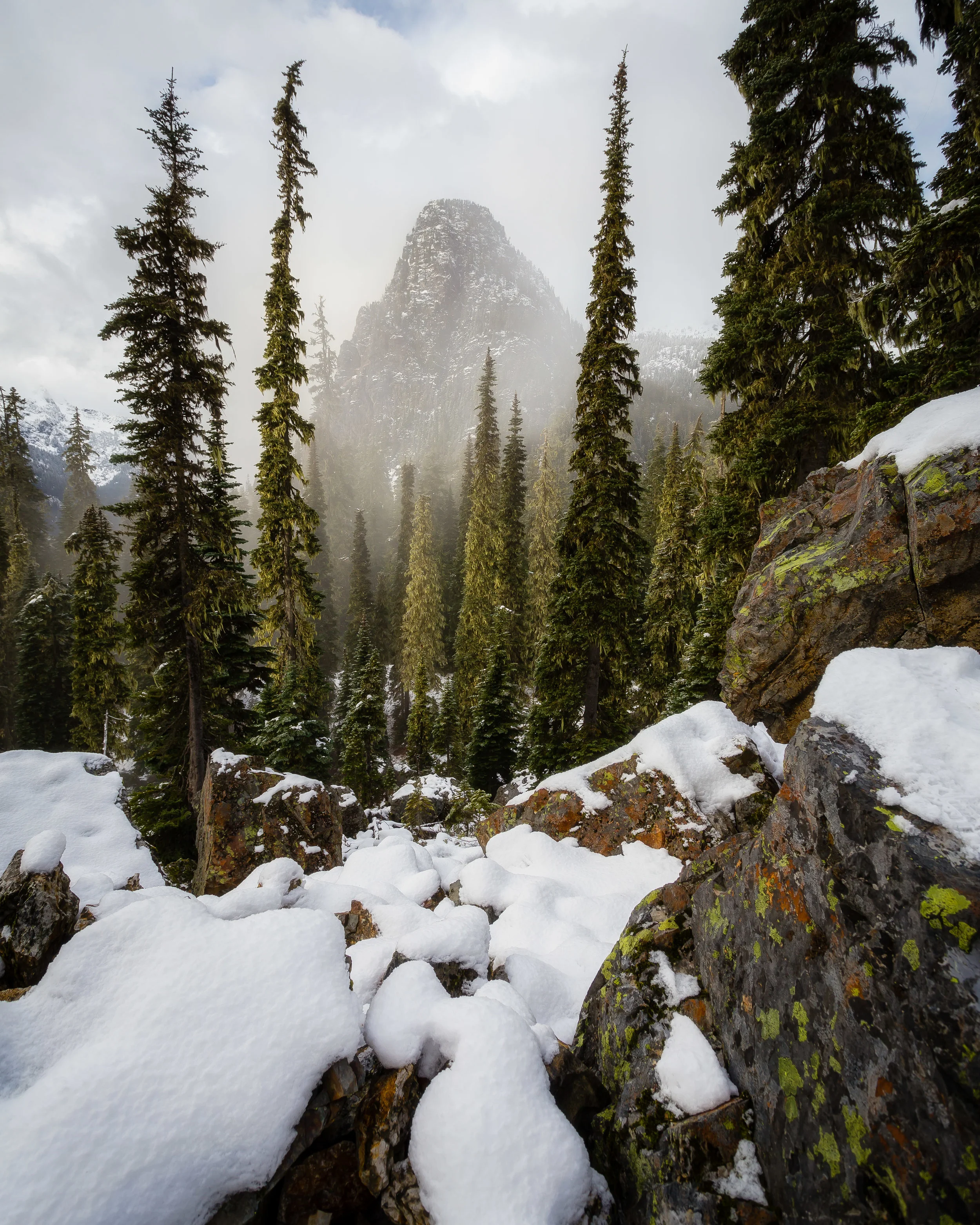
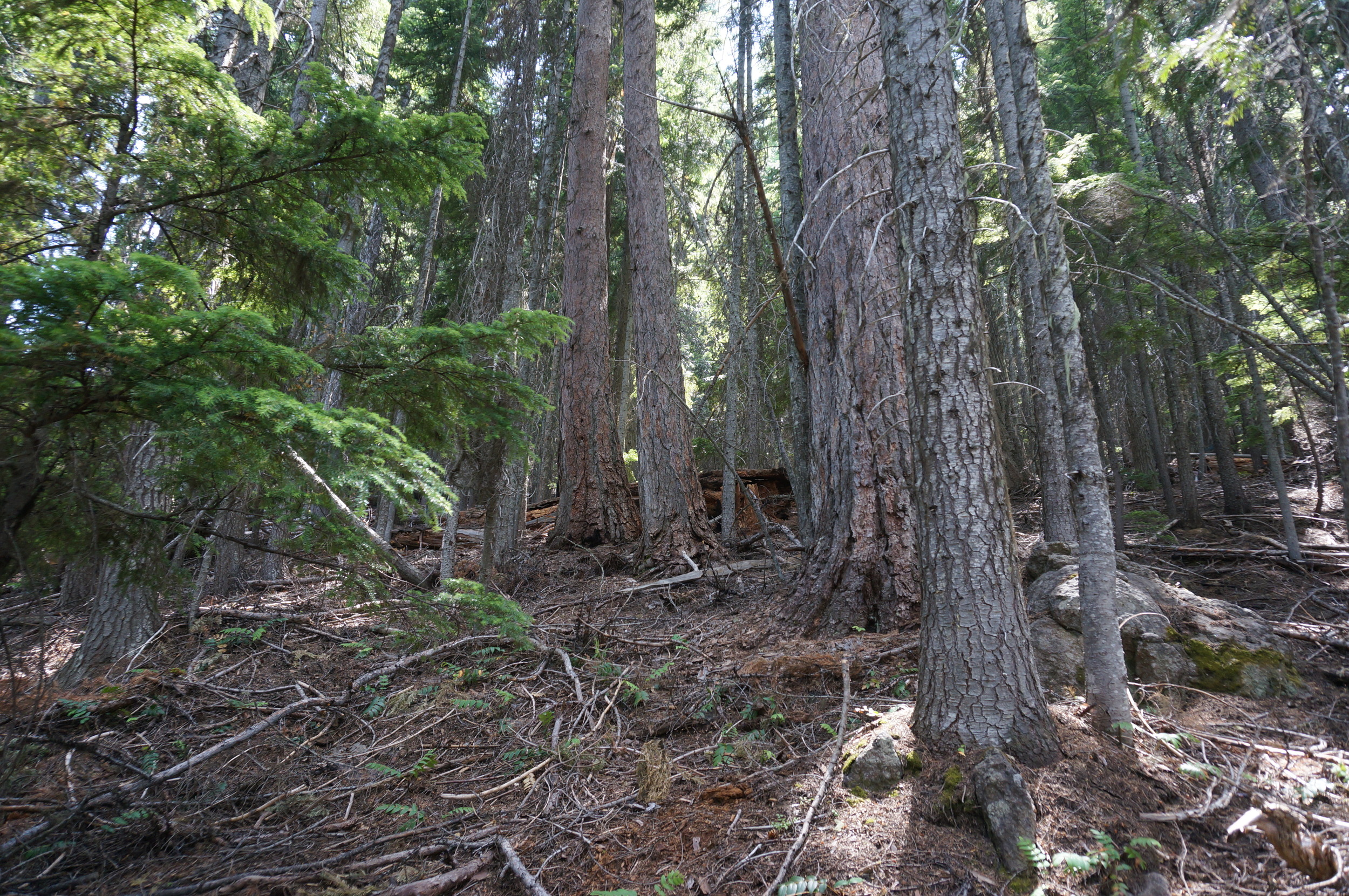
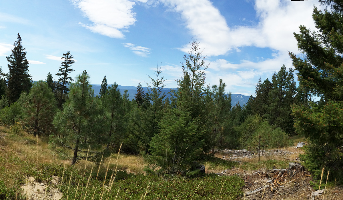
Written & Photographed by Ryan Haugo, Senior Forest Ecologist
Last winter we celebrated the acquisition of 47,982 acres of forestland in the central Cascades from the Plum Creek timber company last winter with lots of high fives and back slaps. Yet we knew that the “real work” still lay ahead of us. We knew that soon we would be very busy writing the Central Cascades Forests Management plan.
What does a management plan for the conservation of nearly 50,000 acres across the central Cascades look like? This plan will cover everything from our overarching conservation objectives to details on recreational access, timber management, and ecological restoration strategies.
Just over six months later and we are deep into the development of the Central Cascades Forests Management Plan. First off was a series of community outreach meetings, in Cle Elum, Ellensburg, Yakima, and Seattle. Now we are busy synthesizing everything we know about these lands and developing the framework to guide management for years to come. Most certainly a daunting task. Luckily, we are able to work with some of the premier ecologists and forest management consultants in WA State, Northwest Natural Resources Group and Stewardship Forestry, in drafting our plan.
What does it take to write a forest management plan for nearly 50,000 acres? Analysis of inventory data, field verification and surveys, ecological modeling, developing maps, and lots of discussion and creative thinking. While this inevitably involves (too much) time in front of computer screens, it also means that we need to get out and get to know these lands in person.
While I’m not sure if we can yet say that the finish line is in sight for the management plan, it is certainly getting closer. I know that the entire team is excited to soon be able to share the details of our plans for these lands. Time and again during the community outreach meetings, I was struck by the long history and deep personal connections that so many people across Washington have with these lands. It is quite a responsibility and honor that we now have to steward these diverse and amazing lands.
Learn more about the Forests for Our Future.

Written and Photographed by Back 40 Outfitters Trail Team Members
The understated photo title, Cup of Coffee, is a play on the powerful and in your face color from the sunset this particular evening on the rooftop of the North Cascades. My father and I had decided to take a special trip away from the hustle and bustle, visiting the site of my very first backpacking trip 15 years ago: Hidden Lake Trail. The trip served a dual purpose: quality time with my dad and testing out the equipment in our Back 40 Outfitters backpacking kit.
Holding a wealth of treasures at the end of the trail, Hidden Lake rewards all travelers who brave the switchbacking 3,000 foot trek through a gorgeous green avalanche chute. Most visitors enjoy the view from the fire lookout, while overnighters drop over the saddle into the North Cascades National Park glacial cirque that holds the cobalt blue water of the lake. From this vantage point, Hidden Lake resembles an infinitely pool poised to cascade off its eastern-most shoulder. We prefer a secluded campsite, perched above the lake to the west with the lookout’s rocky spire looming above. Here, a couple steps in any direction give you a 360-degree view of the granite sentinels that surround you.
After breezing through camp set-up and scrambling to scout the views, we made dinner and found our water source: a trickle of melting snow water on the snowfield below our site. It was interesting to see how the flow of water changed depending on ambient temperature and sun exposure. Evidence: an overnight chill and absence of sun on the west slope had shrunk our water source to slow drip for breakfast.
Finally, the moment that launched my dad’s outdoor modeling career. After dinner we heated leftover water for some coffee to warm up before tucking in for the night. As the August sky began to change color, I hustled to capture the scene and my dad unknowingly climbed himself into the frame. Since the trip, we’ve made a few prints of this shot that now decorate our households and workplace, visual evidence of this awesome trip. The sunset and scenery are truly impressive, but what I love most about this photo is way it captures my dad in his element and reminds me of the impact of his adventuresome spirit on my life.
This photo was captured by Back 40 Outfitters Trail Team member Nate and edited by their staff photographer Eunice Lommen.
Back 40 Outfitters is an outdoor gear rental & events company based in Seattle that specializes in backpacking, car-camping, and concert gear kits. Our service takes all the roadblocks out of camping (we even help brainstorm trip planning) by offering complete equipment packages and a convenient delivery model. They can’t wait to help get you out on adventures like this one. Find them at www.back40outfitters.co and follow their adventures on Instagram @back40outfitters.


Well Worth it – Capturing the Color of the Mountains
Hiking the Enchantments, Alpine Lakes Wilderness
Story and Photographs by Andy Porter
The Enchantments are a part of the Alpine Lakes Wilderness, (which is itself a part of the Wenatchee National Forest) located near the town of Leavenworth, along Highway 2, in Washington State.
The Enchantments area is actually very small, making upmaybe 10 square miles. Packed in to this wondrous world there are scads of small lakes and tarns of fantastic hues of blue and green surrounded by stark jagged peaks. Autumn brings fantastic colors. Because of the high elevation of the Enchantments Basin (between 6,000 and 8,000 feet) there are dense stands of larch. These trees have needles, and come fall they turn a bright orange color, and look like they are aglow from inside.
I spent some time reading about the trail and lakes, the approach and parking and all that. There are two routes in to -or rather up to- the Enchantments Basin. One is very long (12 miles) with a lot (more than 6,000 feet) of elevation gain. The other route is a little shorter, and has a little less elevation gain, but it includes a hike up Aasgard Pass (more than 2,000 feet up in less than one mile).
I recruited two of my friends to help me use the 5-day permit I’d won. I gave them fair (sort of) warning about the hike.
The first day’s short hike took us up to Colchuck Lake. We arrived late in the day and from the lake could see the gash of Aasgard Pass soaring above the lakes far edge. Late morning finds us clambering over the boulder fields along the lake at the base of the trail up. The morning light flares behind the larch atop the pass.
The hike up to the top of the pass was… arduous.
Once you manage to crest the pass you arrive in a wonderland of rock and ice. Dragontail Peak’s serrated edge rips the sky asunder above Isolation Lake. Ice fields dot the lake’s edge. A cool wind and a long drink from the icy stream revive me. There are several inviting tent spots here and we quickly set up our portable North Face fortress and prepare food. There are a smattering of larches up here in the alpine zone, but mostly it’s rocks and water.
The light starts to fade and the colors glow along the lakes shore, the blues, greens and pinkish reds don’t look real at all. Late at night I manage to drag myself out of the tent and capture a few shots of the stars and the tent in this moon-ish looking landscape.
The next day as we start hiking I tell my two friends that this will probably be one of the best days hiking ever. We set out excited to see what the day has to offer.
Skirting a low ridge we drop into a new basin filled with countless ponds. We cross a small snow field as we make our way gently down the trail. Our goal for the day is to establish a new camp on a ledge above Crystal Lake and then hike down to Perfection Lake. From there the plan I have is to make our way up to tiny Gnome Tarn for some wonderful views of Prussik Peak reflected.
Each turn of the trail elicits a new sense of wonder. The larches thicken as we descend.
Overlooking Crystal Lake our new camp gloriously commands a wonderful view. Below us the ridges are crusted in orange larch, offset by the blue skies and green lakes. Once camp is set up we (now without heavy packs!) set out for Perfection.
This basin is on fire with orange. As a true color junky I am juiced to my eyeballs with sensory overload. I feel like I’ve been teleported to a new world, like Avatar, or a scene from Middle Earth. Finding the trail junction amid an orange forest, we branch off and start the easy climb up to Prussik Pass, in search of Gnome Tarn.
A little searching and gawking later were there. The place is as promised, nestled at the base of Prussik Peak, exquisitely framed by larch and water. I enter a photographic trance state.
It’s a perfect day, sunny and warm, a cool breeze refreshes us as we bask in the glory of nature. Lingering for lunch we now set off again. Ambling my way back up to camp I encounter a few hikers who report mountain goats ahead. I arrive back at camp and there is a Mom and her young kid, looking for grass and munching away. A new photo frenzy starts I circumnavigate the goats several times as they make their way about.
Finally tiring of goats and picture taking, I go fire up the stove and make some coffee. My friends return and we marvel at all around us. Dinner is served and eaten just in time for the sunset.
The small ponds make wonderful reflections of the sky. Early the next morning the skies are dark and we head back to to the Pass and start the slow descent to Colchuck Lake. Taking a break on a huge slab precariously perched above a stand of larch I capture one last image of larch and lake.
Andy is a nature photographer lured to Washington State by the glorious vistas. He lives along the North Cascades Highway, where he teaches photography and leads photo tours. You can see more of his work at: www.AndyPorterImages.com


Story and Photography by Andy Porter
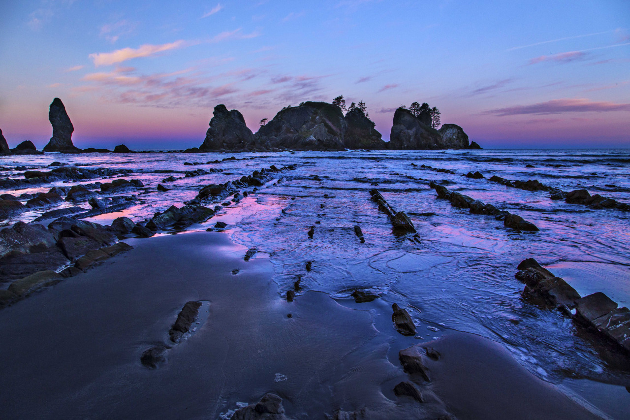
Washington boasts some of the most pristine and untouched coastline anywhere in the lower 48. I normally associate wilderness with the mountains or desert southwest, but here, in Olympic National Park, the beaches are sublime.
Wide sand beaches separated by jagged headlands that cutoff small sections, sea stacks jutting out of the ocean just off shore, forests of driftwood thrown up like matchsticks along the beach, there all make for a fantastic place to hike and camp.
My favorite stretch of Washington coastline is called Point of the Arches. Here you can camp along the water’s edge, and soak in all the air and surf you like. I plan my trips here based on the weather forecast. I have spent many nights here in the cold rain and now have become more of a fair weather visitor. Last week was one of those golden windows, a three day forecast for warmer temps and sun…and in February!
I made my way out to the Olympic Peninsula and finally down to my favorite spot, right in front of the sea stacks and tide pools. Capturing images seaside demands a good amount of luck. The light mid-day is harsh and unforgiving. For this reason I almost never do any day hiking, but rather make the trek in with all that I need to spend a night or 3 and bask in all the glory of wilderness and sea.
I was lucky again. The afternoon shadows lengthened and the light came alive. The glow of the fading sun lit up the rocks and sand.
As the golden hour progressed the colors became more magical. Things could not be better! Late night brought stars and the glow of ships and nearby settlements.
The following morning the sunrise crept up, and then pounced on the shore. The soft colors, like a pastel artist’s image, are so smooth… Luckily I was ready and able to capture a few images before the sun crested the horizon.
Most of my images were captured with a 14mm lens. I also carry a 24-105mm lens, but love the detail and depth of field from the wide angle lens. Make sure to bring a few memory cards, you’ll need them!
Andy is a nature photographer lured to Washington State by the glorious vistas. He lives along the North Cascades Highway, where he teaches photography and leads photo tours. You can see more of his work at: www.AndyPorterImages.com
Did you know? In the late 1970s, Portland heiress and sculptor Marie Louise Feldenheimer wrote a $500,000 check to enable The Nature Conservancy to buy Point of Arches, on the Olympic Coast. When the Conservancy sold the property to the Olympic National Park, the proceeds helped to establish the Land Preservation Fund, a Conservancy revolving fund for acquisitions around the world.